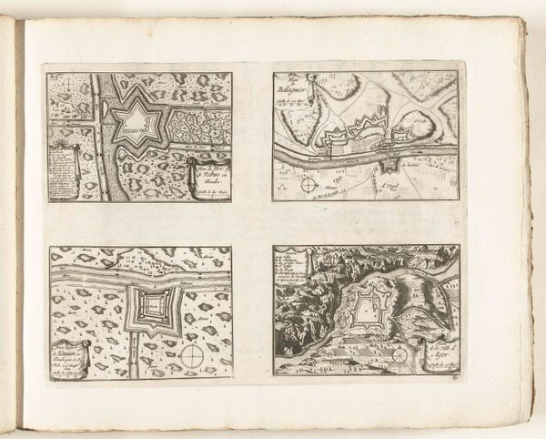
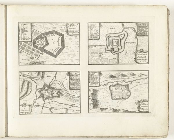
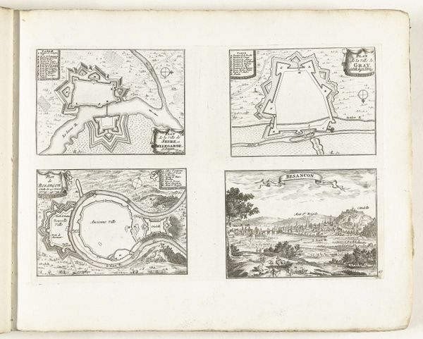
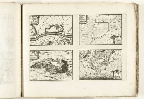
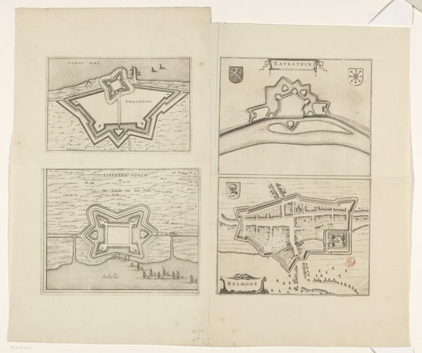
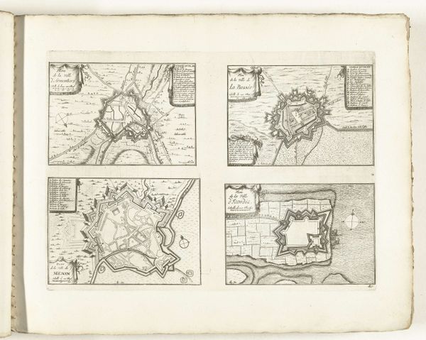
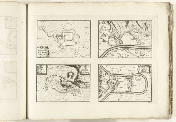
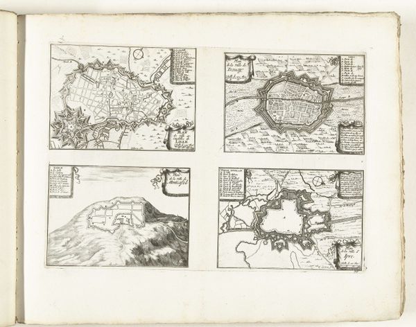
Plattegronden van Breisach, Neuss, Germersheim en Kaiserswerth, ca. 1702 1702 - 1703
0:00
0:00
anonymous
Rijksmuseum
drawing, ink, architecture
#
drawing
#
medieval
#
landscape
#
ink
#
geometric
#
architecture
Dimensions: height 257 mm, width 359 mm
Copyright: Rijks Museum: Open Domain
Curator: Today, we’re looking at "Plattegronden van Breisach, Neuss, Germersheim en Kaiserswerth," a series of city maps rendered around 1702. They are the work of an anonymous artist and executed in ink. Editor: My first impression is of something almost ornamental. Despite the practical intent of these maps, the precision and detail elevate them to a level of visual complexity that’s very appealing. They evoke feelings of precision, yet their small size gives the subject matter an intimate feeling. Curator: Indeed, their objective precision is clear. These drawings showcase the structure of four cities through the formalized depiction of architecture and landscape. The ink work emphasizes clean lines and geometric forms which, viewed through a structuralist lens, speaks to the emphasis on rational urban planning characteristic of the early 18th century. Editor: Yes, but beyond pure geometry, consider the function of such plans. This was a period rife with conflict. City plans weren’t just cartographical exercises; they were strategic tools. These aren’t neutral documents. They represent power, control, and the constant threat of siege. How do the social dynamics influence these seemingly simple forms? Curator: Certainly, understanding the context illuminates aspects of the piece that would otherwise be overlooked. However, what is also striking is how effectively the artist uses line and form to convey a sense of depth, even in what is essentially a two-dimensional representation. This reveals a sophisticated understanding of spatial relations, emphasizing technique over social narrative. Editor: While that's true, it's the social history—the almost obsessive need to map and control territory—that makes the precise detail compelling to me. It’s a visual manifestation of the era's power struggles and colonial aspirations. They speak to how geography becomes inherently tied to politics and identity. Curator: So, in observing "Plattegronden," one can find multiple layers to appreciate: the graphic precision of early cartography along with a tangible sense of strategic depth. Editor: Ultimately, we are faced with a stark visual document revealing how spatial representation is deeply intertwined with political agenda.
Comments
No comments
Be the first to comment and join the conversation on the ultimate creative platform.
More like this