drawing, print, ink, engraving
#
drawing
#
baroque
# print
#
pen sketch
#
pencil sketch
#
landscape
#
ink
#
geometric
#
cityscape
#
engraving
Dimensions: height 404 mm, width 238 mm, height 415 mm, width 264 mm
Copyright: Rijks Museum: Open Domain
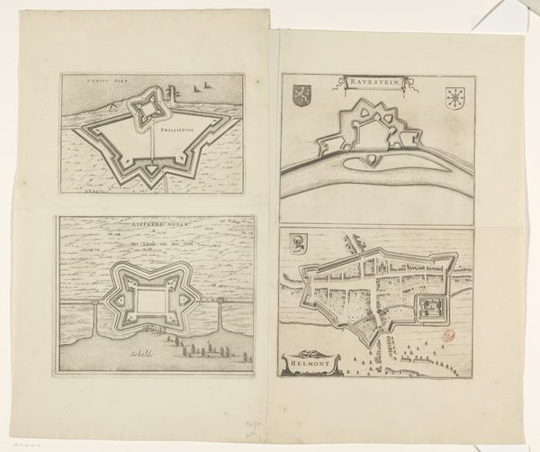
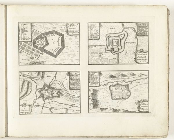
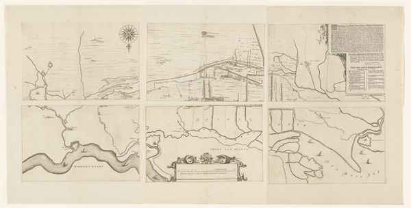
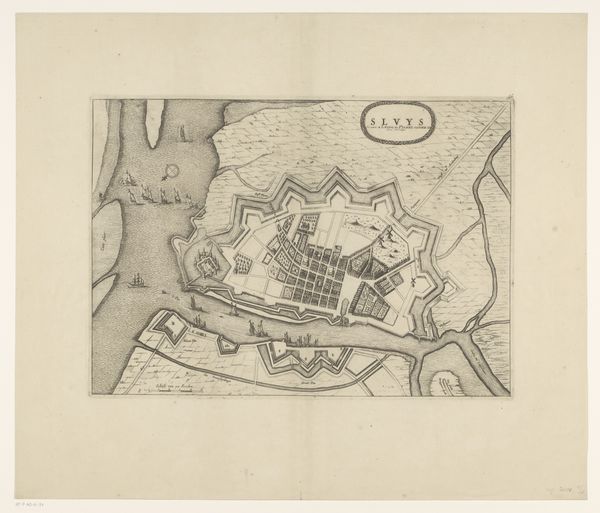
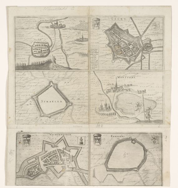
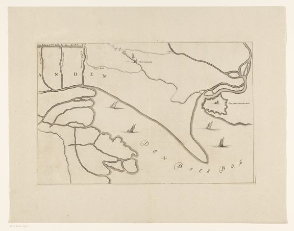
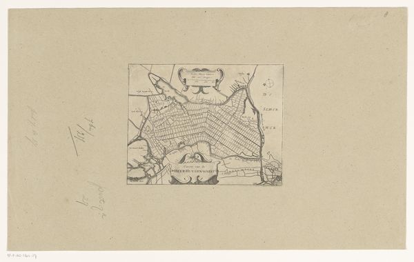
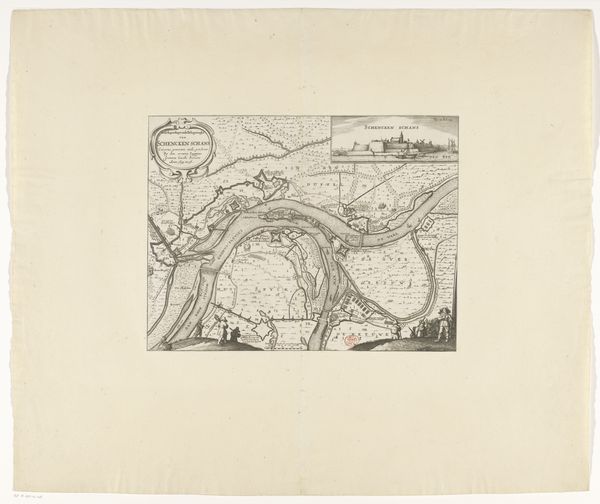
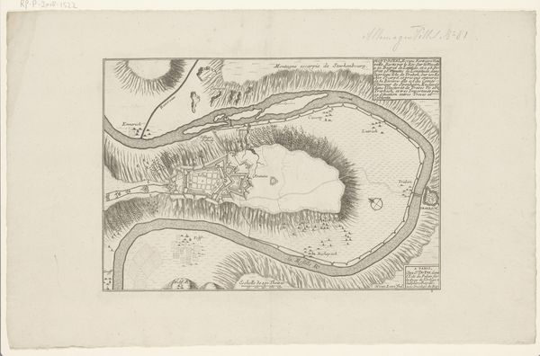
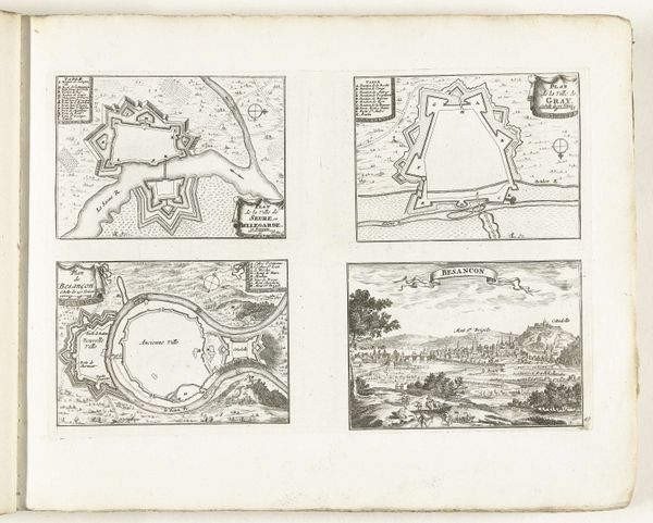
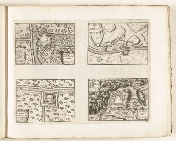
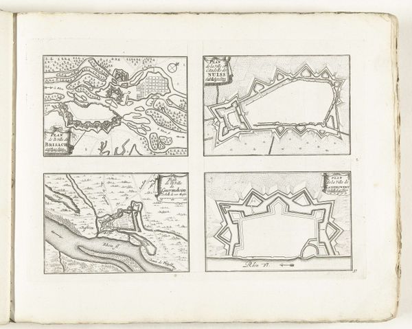
Editor: This print, "Vestingplattegronden van Bredevoort, Axel en Terneuzen", roughly from the mid-17th to early 18th century, offers what appears to be detailed city plans rendered with ink and engraving. What strikes me is their peculiar geometric shape – almost star-like. What can you tell me about them? Curator: These aren't just any city plans; they’re fortification maps. Notice the precise, geometric layout? That’s characteristic of Baroque-era military engineering. These "star forts," as they were called, became prevalent in the 16th and 17th centuries, reflecting the increasing use of cannons. Editor: So, the unusual shape wasn’t just aesthetic? Curator: Not at all. The points of the star are bastions, designed to allow defenders to cover all angles and prevent blind spots. These maps were strategic tools, informing decisions about defense and siege warfare. Consider who these cities were, what conflicts they faced; this informs why investing in updated fortifications were critical to governance and politics. Editor: It’s interesting to think about art having a functional purpose like this. We often separate art and technology, but here they seem intertwined. What can art like this, what does it communicate to us now? Curator: Precisely! These images also show us the rising power of the state, and a drive for centralized power over people; controlling geographic areas like these were vital in military strategy and colonial activities during this time. How does this information reshape your perspective on the artwork? Editor: I initially saw these as aesthetically interesting geometric drawings. Now I see complex sociopolitical statements on state power. Thanks, I'll be chewing on that.
Comments
No comments
Be the first to comment and join the conversation on the ultimate creative platform.
More like this