print, etching
#
dutch-golden-age
# print
#
etching
#
old engraving style
#
landscape
#
etching
Dimensions: height 157 mm, width 200 mm
Copyright: Rijks Museum: Open Domain
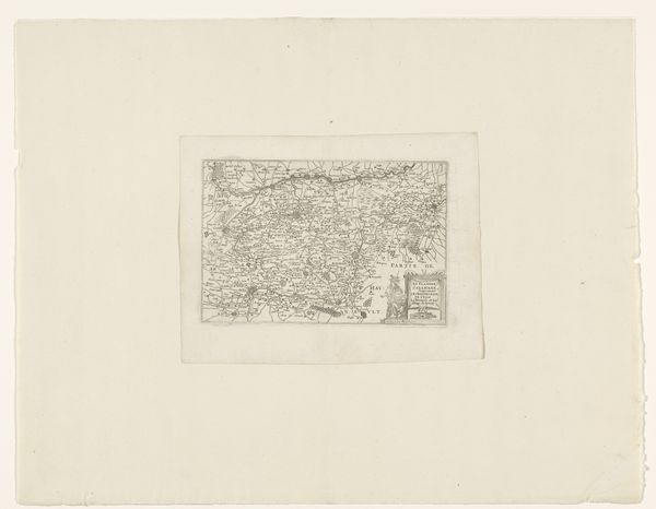
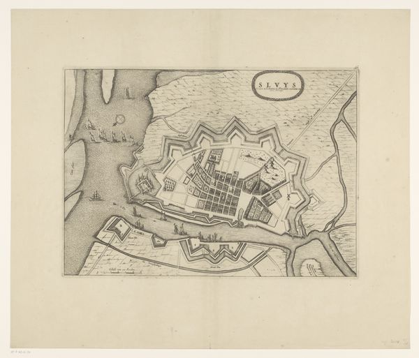
This is a map of the polder the Heerhugowaard, made by an anonymous artist. Its neat lines and ordered structure initially evoke a sense of control over nature. The map's composition, divided into precise geometric shapes, reflects the seventeenth-century Dutch preoccupation with land reclamation and rational planning. Notice how the rigid grid of the polder contrasts with the more organic forms of the surrounding water bodies. This juxtaposition highlights a tension between the natural and the artificial, a recurring theme in Dutch art and culture of this period. The lines, acting as signifiers, create a semiotic system that communicates ownership, division, and control. The map is not just a representation of space, but also an embodiment of power. It invites us to consider how cartography itself can be a tool for shaping our perception of the world, reinforcing certain ideologies, and challenging fixed notions of space and territory.
Comments
No comments
Be the first to comment and join the conversation on the ultimate creative platform.
More like this