print, engraving
baroque
cityscape
history-painting
engraving
Dimensions: height 500 mm, width 545 mm
Copyright: Rijks Museum: Open Domain
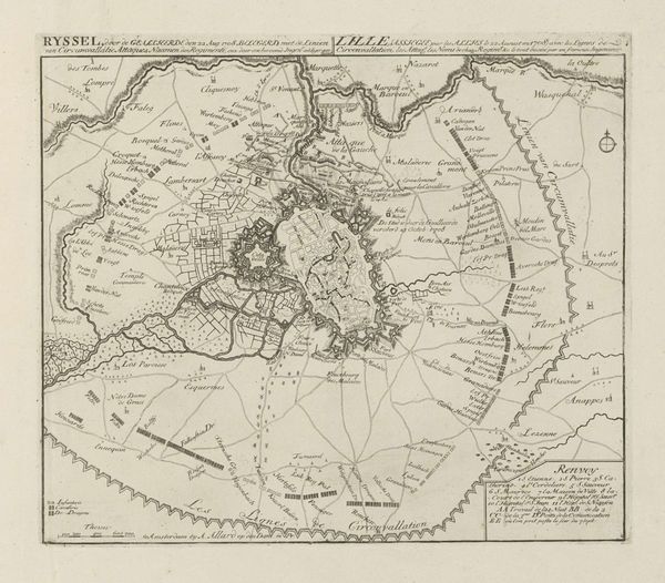
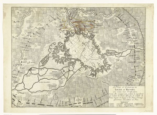
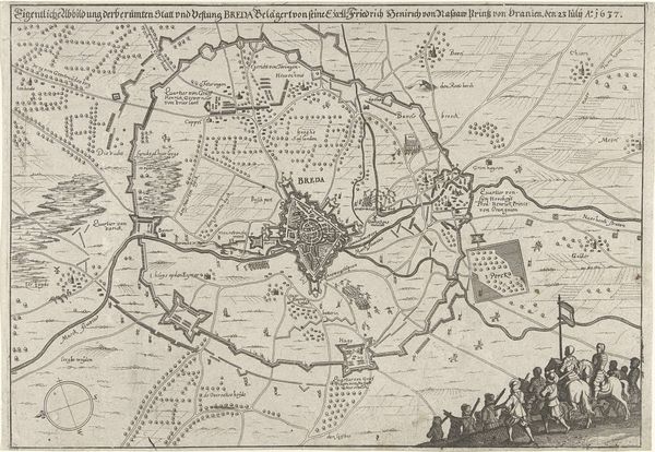
This is an anonymous map, ‘Kaart van het beleg van Lille, 1708’, depicting the siege of Lille during the War of the Spanish Succession. At the turn of the 18th century, cartography was not merely about geographical accuracy; it was deeply enmeshed with power, strategy, and identity. Maps like this were tools of war, designed to aid military planning and assert territorial claims. Lille, now in France, but then a key city in the Spanish Netherlands, was under siege by the allied forces of the Dutch Republic, Great Britain, and the Holy Roman Empire. The detailed rendering of fortifications and troop positions speaks volumes about the priorities of the mapmakers. It offers a silent narrative of the battles, strategies, and human cost of the siege. This map, beyond its practical function, encapsulates the tensions and ambitions of an era defined by dynastic struggles and shifting allegiances. It reminds us that every line and landmark drawn carries the weight of history.
Comments
No comments
Be the first to comment and join the conversation on the ultimate creative platform.