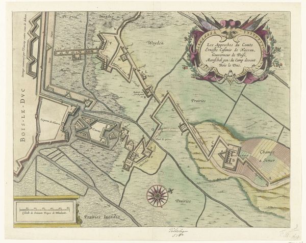
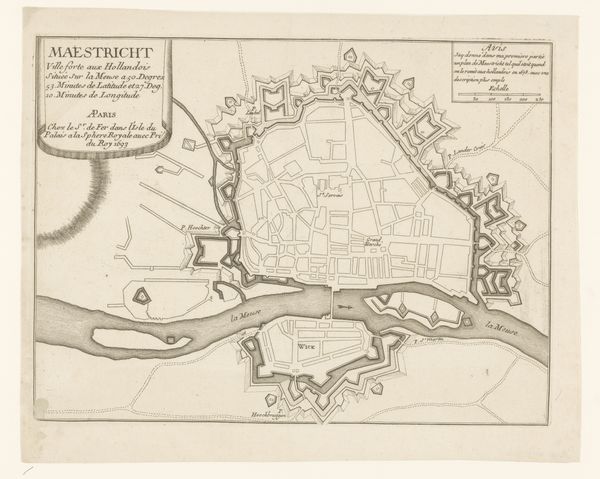
Loopgraven van het Staatse leger vanaf het fort Sint-Anthonie tot aan de stad, tijdens het beleg van Den Bosch, 1629 1629 - 1630
0:00
0:00
print, engraving
#
dutch-golden-age
# print
#
landscape
#
cityscape
#
engraving
Dimensions: height 295 mm, width 378 mm
Copyright: Rijks Museum: Open Domain
Editor: So, this print, “Loopgraven van het Staatse leger vanaf het fort Sint-Anthonie tot aan de stad, tijdens het beleg van Den Bosch, 1629,” made around 1629-1630 by an anonymous artist, illustrates a siege. The delicate engraving almost makes the scene look peaceful, but you know there's conflict underlying it. What do you see in this piece, considering its cartographic nature? Curator: Intriguing, isn't it? Let us focus on the intrinsic compositional elements. The map’s visual power comes from the calculated arrangement of lines and shapes, the sharp contrasts defining each topographical feature. Observe the rhythmic repetition of geometric forms that represent fortifications; how do those sharp, angular lines interact with the fluid, organic curves of the rivers? Editor: I see what you mean; the forts are like aggressive interruptions in the landscape. Curator: Precisely. Furthermore, consider the color palette—the restrained use of pastel shades emphasizes the flatness of the picture plane. The delicate tints provide a serene overlay but hardly veil the violence. Ask yourself what meaning resides in these artistic choices? Editor: Maybe the muted colors reflect the strategic nature of the siege itself, as if draining the color meant draining the life out of the city? It also draws more attention to the lines. Curator: An interesting observation. The lines aren't simply representational; they're constitutive of the image’s formal architecture, dividing space, defining boundaries. It showcases a calculated formal vocabulary. Consider how a more emotive style might detract from its function. Editor: So, form and function become inseparable here? It gives me a fresh perspective, thinking about this as more than just a historical document. Curator: Exactly. These seemingly disparate elements coalesce to reveal the artwork’s structural coherence and symbolic power. We moved beyond its ostensible historical function.
Comments
No comments
Be the first to comment and join the conversation on the ultimate creative platform.
More like this