drawing, paper, ink, pen
#
drawing
#
baroque
#
pen sketch
#
sketch book
#
paper
#
ink
#
pen
#
cityscape
#
history-painting
#
watercolor
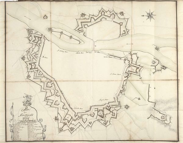
Dimensions: height 530 mm, width 580 mm
Copyright: Rijks Museum: Open Domain
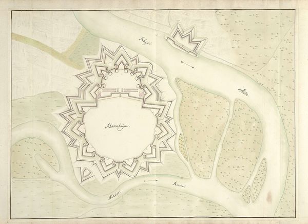
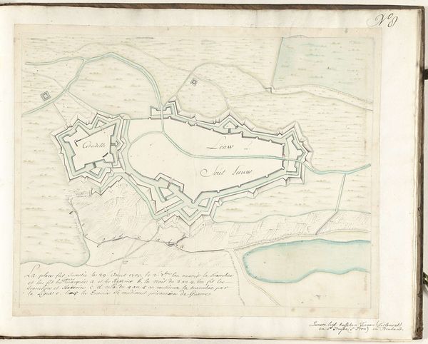
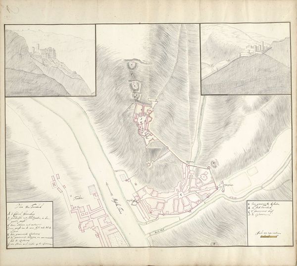
Around 1701-1715, Samuel Du Ry de Champdoré created this drawing of the city of Limbourg. This isn't simply a map, it’s a strategic document, reflecting the intense geopolitical competition in Europe at the time. The map meticulously details Limbourg’s fortifications and surrounding terrain. Notice the star-shaped fortresses, typical of military engineering of the era, designed to offer maximum defensive capability. These details offer insight into the priorities of the ruling powers. Limbourg, located in what is now Belgium, was a contested territory. The map's creation coincides with the War of the Spanish Succession, a major European conflict. States like France, Austria and the Netherlands fought for control over this area. Maps like these were crucial for planning military campaigns. They highlight how art served the needs of statecraft. To fully understand this image, we would need to consult military archives and historical records. By placing art within its historical context, we see how it reflects the social, political and institutional forces at play.
Comments
No comments
Be the first to comment and join the conversation on the ultimate creative platform.
More like this