drawing, ink, engraving
#
architectural sketch
#
drawing
#
dutch-golden-age
#
perspective
#
ink
#
geometric
#
cityscape
#
engraving
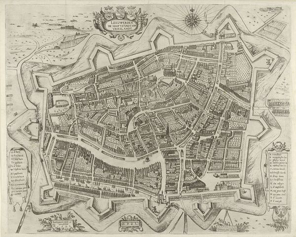
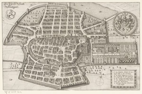
Dimensions: height 395 mm, width 493 mm
Copyright: Rijks Museum: Open Domain
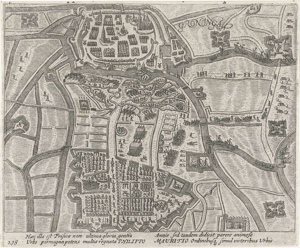
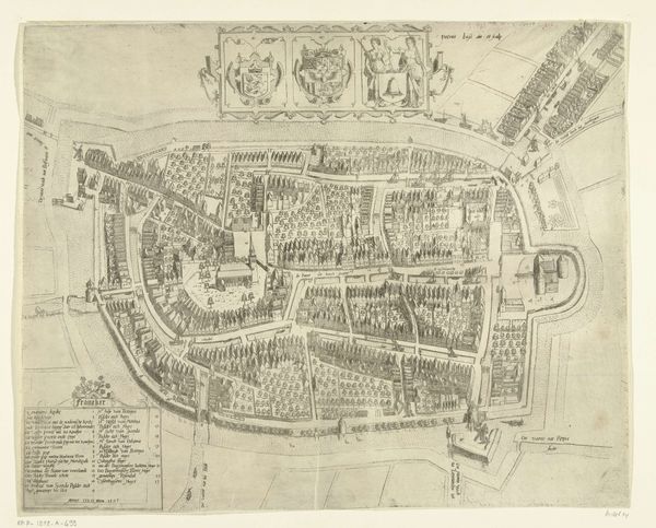
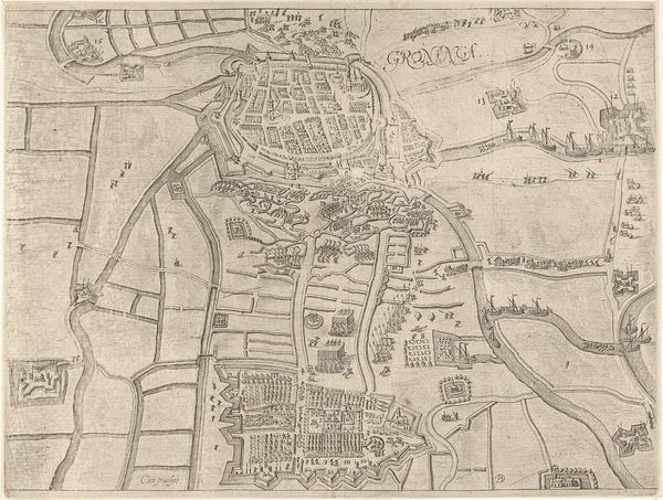
Curator: Here we have Pieter Bast’s “Plattegrond van Leeuwarden, 1603,” an ink and engraving on paper. The Rijksmuseum holds it now, offering us a bird’s-eye view into this early 17th-century Dutch city. What’s your first impression? Editor: It feels meticulous, almost obsessively detailed, doesn’t it? There’s a real dedication to accuracy visible. Look at how even the little rows of trees have been included. But it also has a flat quality. It's like someone ironed a three-dimensional town. Curator: Absolutely. Bast meticulously records not just buildings, but defensive walls and agricultural patterns around the town itself. This piece really shines a light on the methods and skills present within the world of Dutch cartography and the printing trades. Engravings like these served multiple functions, from practical navigational tools to emblems of civic pride. Imagine the workshops filled with artisans. The ink, the paper, the intense labour—a potent blend of artistry and production. Editor: You’re so right about the labor. Think of all the preliminary surveys! To render all this at this scale by hand, without even thinking about the printing process…I’m so fascinated with the idea of consuming these kind of maps. As ways of showcasing your influence or literally figuring out how to dodge your neighbour when heading to market, maps were deeply tied to identity. Even today the materiality is something to be explored, tracing the lines with your finger and trying to connect yourself to that moment. It all resonates with layers of social and material implications. I feel like there’s some kind of poetry there as well; this meticulous ordering hints at anxieties or maybe fantasies of control. Does that register with you at all? Curator: Most certainly, these maps really offered early viewers a kind of comprehensive world-building that probably allowed a really strong visual grasp of the concept of “control” and urban expansion during a pivotal time for the Republic. Maps are definitely a perfect mix of ambition and practicality; each engraving marks someone’s perspective made real. They also offer tangible entry points to connect with history, culture, and place. It feels powerful to see these works together as ways of trying to understand it all.
Comments
No comments
Be the first to comment and join the conversation on the ultimate creative platform.
More like this