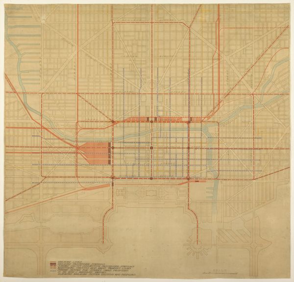
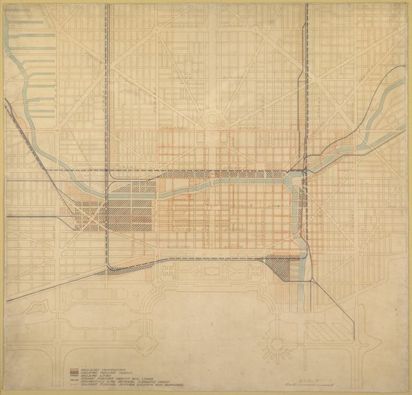
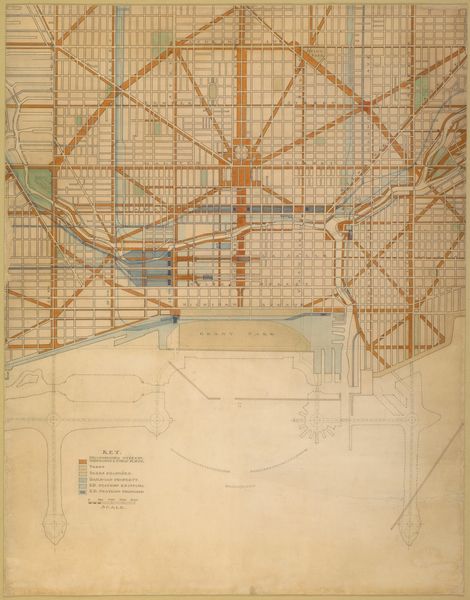
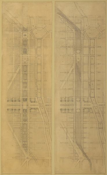
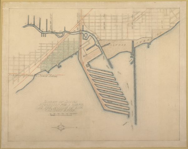
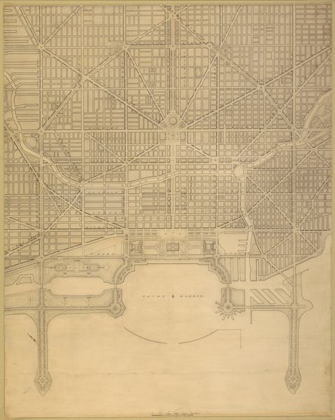
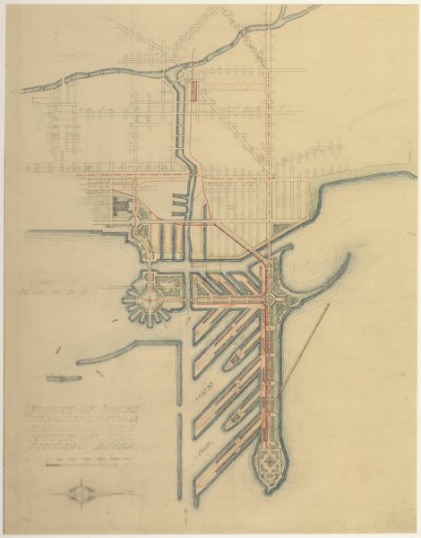
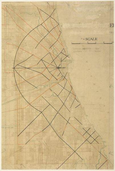
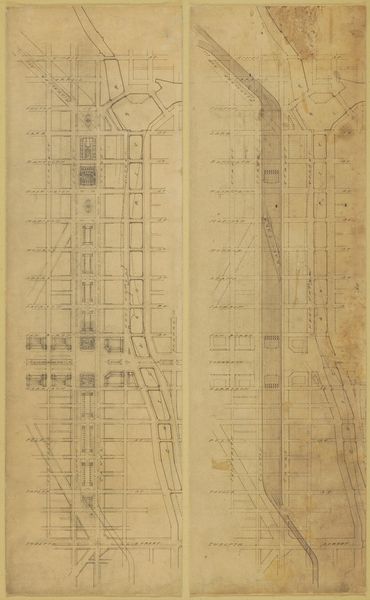
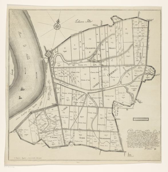
Plate 75 from The Plan of Chicago, 1909: Chicago. Diagram of the City, Showing Complete System of Inner Circuits 1909
0:00
0:00
drawing, architecture
#
drawing
#
etching
#
cityscape
#
watercolor
#
architecture
Dimensions: 75.4 × 89.4 cm (29 3/4 × 35 1/4 in.)
Copyright: Public Domain
Curator: The etching, watercolor, and drawing titled "Plate 75 from The Plan of Chicago, 1909: Chicago. Diagram of the City, Showing Complete System of Inner Circuits," by Daniel Hudson Burnham offers a fascinating glimpse into urban planning ideals of the early 20th century. Editor: It strikes me immediately as a ghost city, or perhaps the skeletal blueprint for one. Those stark red lines, they look like arteries in a body not quite formed, a body politic perhaps. Curator: Indeed, this piece emerged during a period of intense social reform and anxieties regarding urbanization. Consider the era’s rapidly expanding industrial cities and the associated challenges of poverty, overcrowding, and sanitation. Burnham's plan, in its entirety, sought to remedy these issues, to instill order and beauty within the urban landscape, shaping civic identity and addressing inequities of class and resource allocation through infrastructure and the design of public spaces. Editor: I am drawn to the materiality. It is not just a blueprint but is an object crafted, considered: the etching, watercolor, and ink – how were these materials sourced, circulated, and valued? Who made them accessible to Burnham and his team? This city plan emerges from layers of physical and conceptual labor. Curator: That is very perceptive. These intricate renderings were created and disseminated to galvanize support for the Plan, which inevitably catered to the wealthy and further marginalized working-class neighborhoods and people of color. Think about how the very act of mapping imposes a particular vision, obscuring the lived realities of those relegated to its margins. These margins become especially clear by analyzing race, gender and other facets of urban planning. Editor: Yes, look at those meticulously rendered railway lines! The diagram prioritizes the efficient movement of goods and people but at whose expense? It shows investment and development to some, and the extraction of labour for others. What raw materials fed this imagined Chicago? What communities were displaced to build it? We can also consider it a kind of early information technology, mapping a circulatory system as crucial as the waterways for the growth and distribution of raw materials. Curator: And that's precisely where this diagram holds such power. It allows us to confront the enduring legacies of urban planning—to grapple with questions of social justice, spatial equity, and the ethical responsibilities inherent in shaping the environments we inhabit. Editor: This work forces us to ask not only *what* the city is but also *how* it is made. The planned environment hides the means of production within it.
Comments
No comments
Be the first to comment and join the conversation on the ultimate creative platform.
More like this