print, engraving
#
aged paper
#
dutch-golden-age
# print
#
old engraving style
#
geometric
#
cityscape
#
decorative-art
#
engraving
Dimensions: height 176 mm, width 205 mm
Copyright: Rijks Museum: Open Domain
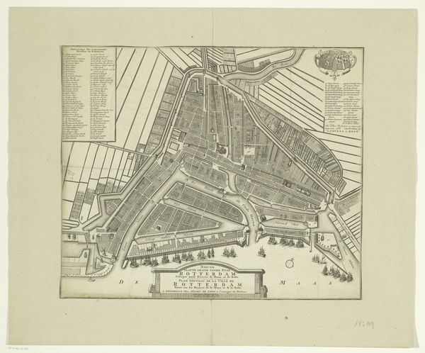
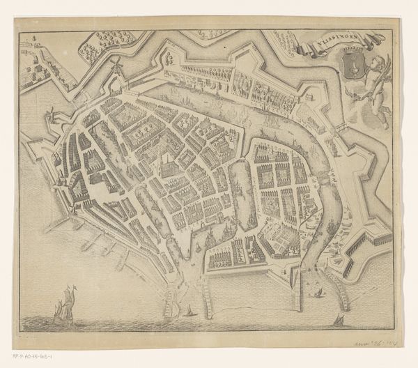
This is an anonymous 18th-century map of Rotterdam, later improved by J. Kortebrant and published in Amsterdam in 1742. Historical maps are never neutral, and this one speaks volumes about power, trade, and identity in the Dutch Golden Age. Rotterdam, a vital port city, was a hub for global exchange, but also deeply implicated in the colonial project. This map, with its precise detailing of streets, waterways, and fortifications, reflects a desire to control and manage urban space. The detailed labeling in the upper left-hand corner highlights key locations, but also hints at a society structured by commerce and religion. While the map appears to offer a comprehensive view, we must ask: Whose perspectives are included, and whose are left out? What stories do these streets and buildings conceal about the lives of ordinary people, of women, of people of color who lived and worked in this bustling city? Consider what a map like this might have meant to those who sought to navigate or govern Rotterdam. It's a representation, but it's also a tool—a way of shaping perceptions and reinforcing social hierarchies.
Comments
No comments
Be the first to comment and join the conversation on the ultimate creative platform.
More like this