drawing, print, etching, ink
#
drawing
# print
#
etching
#
landscape
#
ink
#
geometric
#
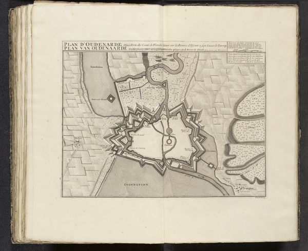
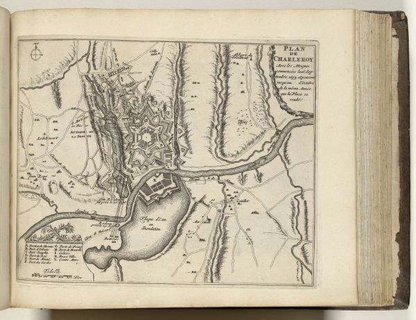
cityscape
Dimensions: height 202 mm, width 278 mm
Copyright: Rijks Museum: Open Domain
Harmanus van Loon created this ‘Plattegrond van Antwerpen’ in 1693, a period marked by significant political and cultural shifts in Europe. Van Loon, born in 1649, was working in a world where cartography intertwined with national identity and geopolitical strategy. This map isn’t merely a depiction of Antwerp; it’s a statement of power and perspective. Consider the act of mapping itself – who gets to define and represent a space? Maps like this were tools of empire, used to claim territories and solidify control. The detailed rendering of Antwerp, surrounded by fortifications, speaks to the city's strategic importance and the constant threat of conflict. Note the river Escaut, not just a geographical feature but a vital artery for trade and defense. The map invites us to reflect on the human stories embedded in these landscapes – stories of merchants, soldiers, and ordinary citizens whose lives were shaped by the forces represented here. It highlights the intersection of geography, power, and identity, reminding us that every map tells a particular story.
Comments
No comments
Be the first to comment and join the conversation on the ultimate creative platform.
More like this