About this artwork
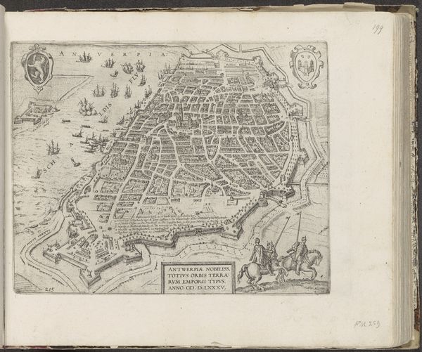
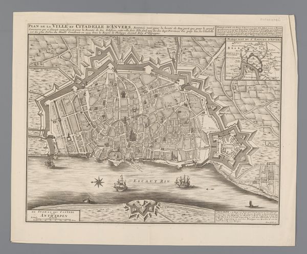
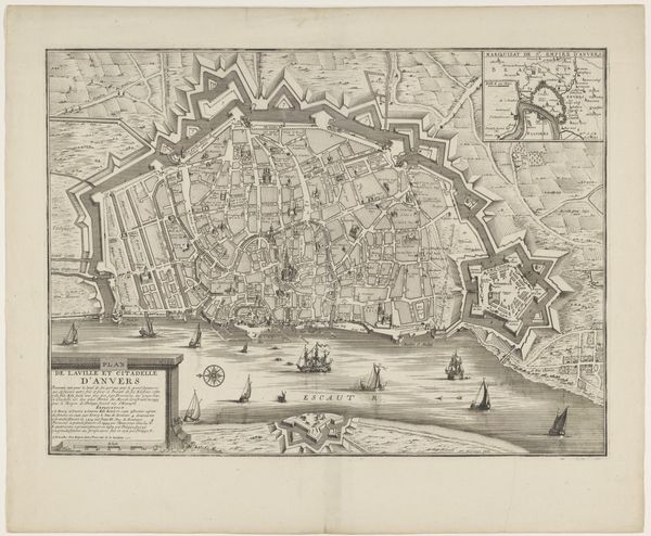
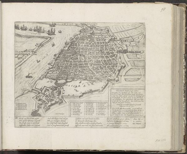
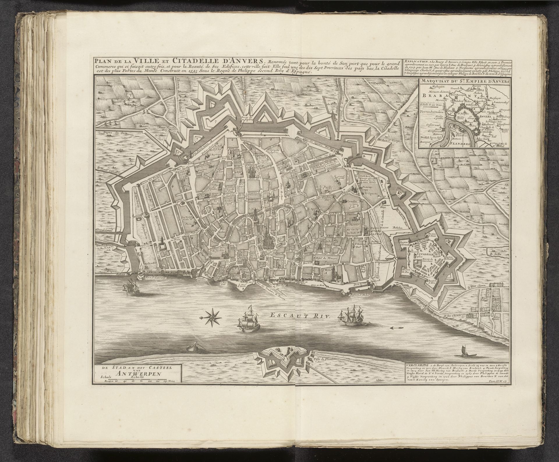
Editor: This is a print titled "Plattegrond van Antwerpen, ca. 1701-1713," created by Jacobus Deur. It dates from 1727-1729 and it is on display at the Rijksmuseum. It's like stepping back in time to examine a city block by block! The detail is incredible. What strikes you most about it? Curator: What a great choice! It feels a bit like peeking over someone's shoulder as they painstakingly documented their world. For me, it’s how Deur marries functionality with artistry. It’s more than just a map; it's a story of Antwerp at a pivotal point. You can see the fortifications, these almost theatrical star-shaped fortresses protecting the city. What do they whisper to you? Editor: They feel so...permanent. And also vulnerable, in a way? I guess, imagining attacks on the city. It's hard to believe this was all done by hand. Curator: Exactly! Remember, each line, each little building was deliberately etched. There’s a beauty in that level of care, don't you think? The texture of the aged paper almost adds to that, the knowledge of passing time... But if you really want a secret revealed... what is he leaving OUT? What biases may lurk behind the seemingly objective truth of this map? Editor: Oh wow, that's something to consider, a deliberate point of view that may change historical perspectives forever. This makes you wonder about the entire period. Thanks for sharing all this, I can’t wait to share with others now. Curator: Likewise! Happy travels...through time, that is!
Plattegrond van Antwerpen, ca. 1701-1713 1727 - 1729
Jacobus Deur
@jacobusdeurLocation
RijksmuseumArtwork details
- Medium
- graphic-art, print, engraving
- Dimensions
- height 438 mm, width 545 mm
- Location
- Rijksmuseum
- Copyright
- Rijks Museum: Open Domain
Tags
graphic-art
aged paper
toned paper
baroque
pen sketch
sketch book
landscape
personal sketchbook
pen-ink sketch
pen and pencil
pen work
sketchbook drawing
cityscape
sketchbook art
engraving
Comments
No comments
About this artwork
Editor: This is a print titled "Plattegrond van Antwerpen, ca. 1701-1713," created by Jacobus Deur. It dates from 1727-1729 and it is on display at the Rijksmuseum. It's like stepping back in time to examine a city block by block! The detail is incredible. What strikes you most about it? Curator: What a great choice! It feels a bit like peeking over someone's shoulder as they painstakingly documented their world. For me, it’s how Deur marries functionality with artistry. It’s more than just a map; it's a story of Antwerp at a pivotal point. You can see the fortifications, these almost theatrical star-shaped fortresses protecting the city. What do they whisper to you? Editor: They feel so...permanent. And also vulnerable, in a way? I guess, imagining attacks on the city. It's hard to believe this was all done by hand. Curator: Exactly! Remember, each line, each little building was deliberately etched. There’s a beauty in that level of care, don't you think? The texture of the aged paper almost adds to that, the knowledge of passing time... But if you really want a secret revealed... what is he leaving OUT? What biases may lurk behind the seemingly objective truth of this map? Editor: Oh wow, that's something to consider, a deliberate point of view that may change historical perspectives forever. This makes you wonder about the entire period. Thanks for sharing all this, I can’t wait to share with others now. Curator: Likewise! Happy travels...through time, that is!
Comments
No comments