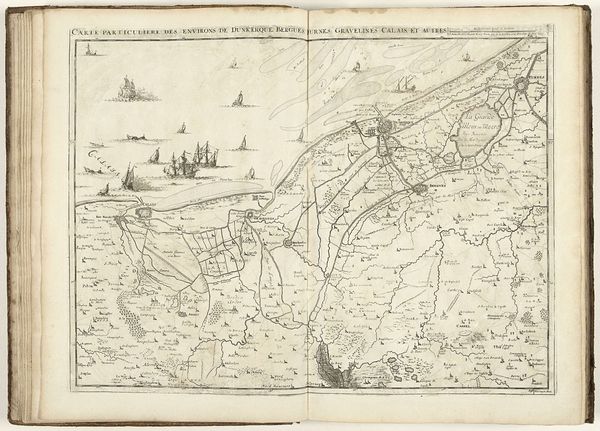
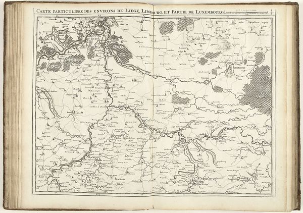
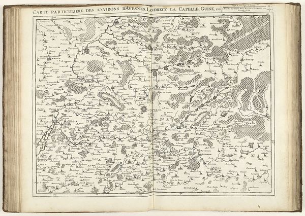
Kaart van de kust van Noord-Frankrijk met de mondingen van de Somme en de Bresle, 1710 1710
0:00
0:00
jacobusharrewijn
Rijksmuseum
#
pen drawing
#
mechanical pen drawing
#
pen sketch
#
old engraving style
#
personal sketchbook
#
ink drawing experimentation
#
pen-ink sketch
#
pen work
#
sketchbook drawing
#
sketchbook art
Dimensions: height 437 mm, width 560 mm
Copyright: Rijks Museum: Open Domain
This is Jacobus Harrewijn’s 1710 map of the coast of Northern France, rendered in ink. The map, presented as an open book, creates a formal juxtaposition between geographical precision and artistic representation. Look at how Harrewijn uses delicate lines and detailed engravings to delineate coastlines, rivers, and settlements. The composition is structured by a clear division between land and sea, with topographical features rendered through a meticulous arrangement of tiny symbols and words. These are not merely descriptive but symbolic, acting as signs within a semiotic system. The scale is subtly distorted, prioritizing key geographical and political points, reflecting the mapmaker's intent to convey strategic information. Consider how Harrewijn plays with form and structure. The formal elements of the map, such as line, texture, and composition, do more than just represent the coast of Northern France; they invite us to consider the relationship between space, knowledge, and power in the early 18th century.
Comments
No comments
Be the first to comment and join the conversation on the ultimate creative platform.
More like this