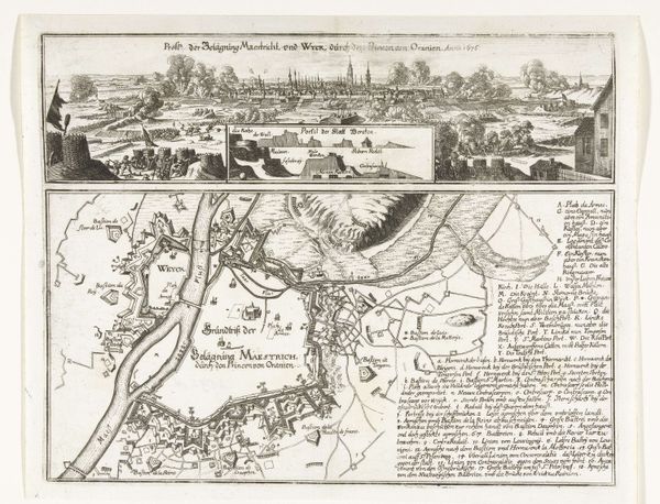
Profiel van Amsterdam met een kaart van de blokkade door de troepen van Willem II, 1650 1650 - 1652
0:00
0:00
anonymous
Rijksmuseum
drawing, ink, pen, engraving
#
drawing
#
ink drawing
#
pen drawing
#
dutch-golden-age
#
ink
#
pen
#
cityscape
#
engraving
Dimensions: height 299 mm, width 384 mm
Copyright: Rijks Museum: Open Domain
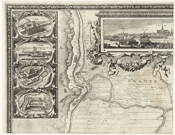
This engraving, "Profiel van Amsterdam met een kaart van de blokkade door de troepen van Willem II, 1650," presents a dual perspective of Amsterdam. Above, a panoramic profile captures the city’s skyline with its distinctive windmills and towers. Below, a detailed map delineates the surrounding region, charting waterways, villages, and fortifications. The stark linearity of the engraving emphasizes spatial organization. Notice how the cityscape flattens against the intricate network of lines mapping the terrain below, creating a tension between representation and abstraction. The lines do not merely depict geographical features; they structure the viewer's understanding of space and power. Consider how this formal arrangement invites us to reflect on the relationship between visual representation, knowledge, and control. The city profile offers a visual spectacle, while the map claims a cartographic dominion. It's a visual dialogue that destabilizes any singular reading, opening a space for ongoing interpretation and re-interpretation.
Comments
No comments
Be the first to comment and join the conversation on the ultimate creative platform.
More like this