drawing, print, ink, engraving
#
drawing
#
dutch-golden-age
# print
#
landscape
#
ink
#
cityscape
#
engraving
Dimensions: height 548 mm, width 651 mm
Copyright: Rijks Museum: Open Domain
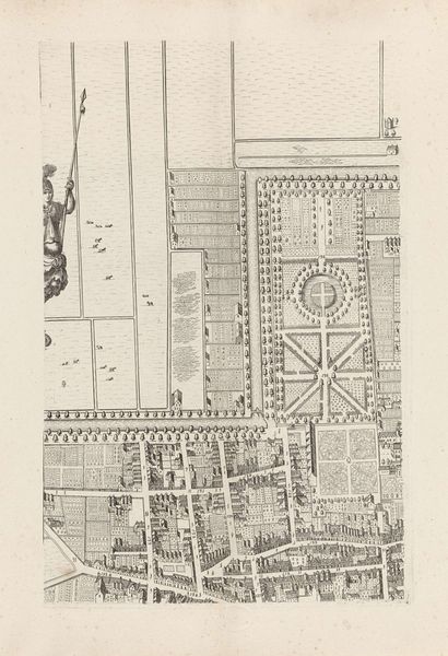
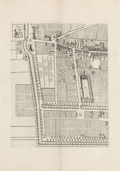
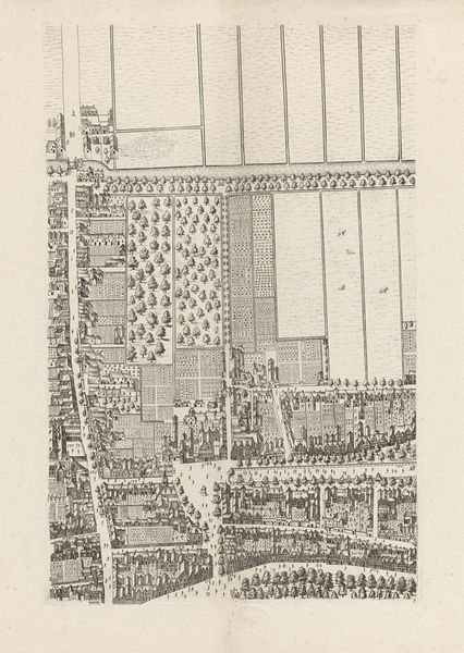
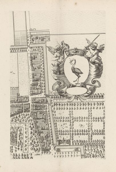
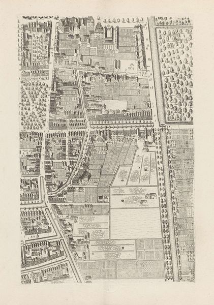
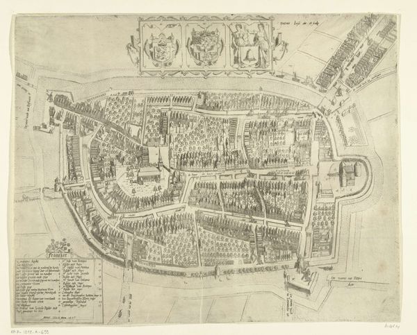
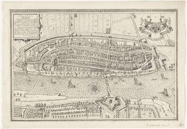
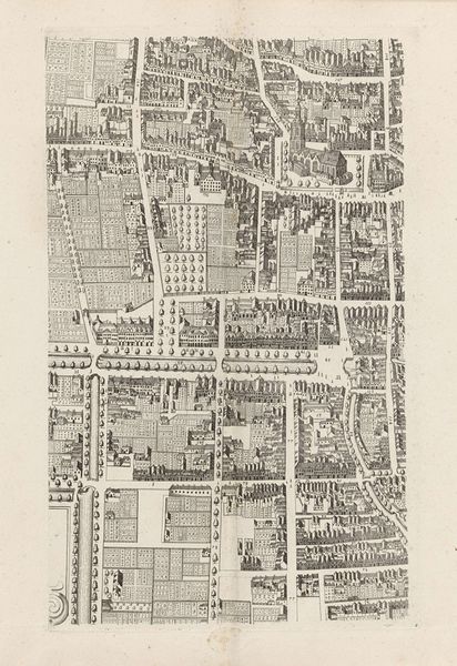
Curator: The level of detail here is amazing! We are looking at Cornelis Elandts’ "Plattegrond van Den Haag (twaalfde deel)", possibly created between 1665 and 1682. It’s a detailed cityscape rendered in ink and engraving. Editor: Yes, intricate. The print has a sort of austere beauty, all precise lines and carefully rendered buildings. It makes me think about urban planning, about control, but it looks remarkably green. Curator: Absolutely. City maps served many functions. They weren't just geographical tools; they were potent symbols. The placement of structures, their relationship to one another, even the inclusion of details like windmills—all convey meaning. Look at the coat of arms. It signifies power, patronage and legitimation. Editor: True, but how was this thing actually *made*? I am particularly curious about the labour involved in engraving a copper plate with such intricate detail, transferring all these visual records from survey to print, ensuring the accurate transfer. The artist functions here as artisan, chronicler, urbanist and social agent all in one. Curator: Precisely. The visual vocabulary carries layers of cultural memory. The depiction of waterways speaks volumes about the relationship between the city and its resources, its connections to the wider world. Even the typeface carries its own cultural history. The arrangement conveys a symbolic, authoritative truth. Editor: Well, even if its purpose was authoritative, this isn't an objective depiction of “truth”. We shouldn’t forget the material limits involved. There’s a level of abstraction—a loss of sensory detail involved with these representational practices. The lived experience would be quite distinct from how it is codified here. But even so, the labor that went into that translation feels extraordinary. Curator: Yes, but abstraction always carries meaning, highlighting certain elements and downplaying others. In a way it enhances its symbolic utility. For the viewer of the time, these emblems evoked social relations as much as geographic space. It allows people to have shared reference points of cultural identity and urban cohesion. Editor: So, from different angles, both the labour involved and the embedded symbolism can suggest an important historic perspective. It's the material and immaterial meeting at a point in the Dutch Golden Age. Curator: Exactly. A testament to the city's enduring presence and the artist's interpretation of place and belonging.
Comments
No comments
Be the first to comment and join the conversation on the ultimate creative platform.
More like this