print, engraving
#
baroque
# print
#
pen sketch
#
geometric
#
line
#
cityscape
#
engraving
Dimensions: height 181 mm, width 220 mm
Copyright: Rijks Museum: Open Domain
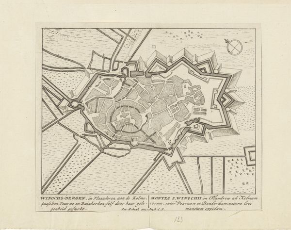
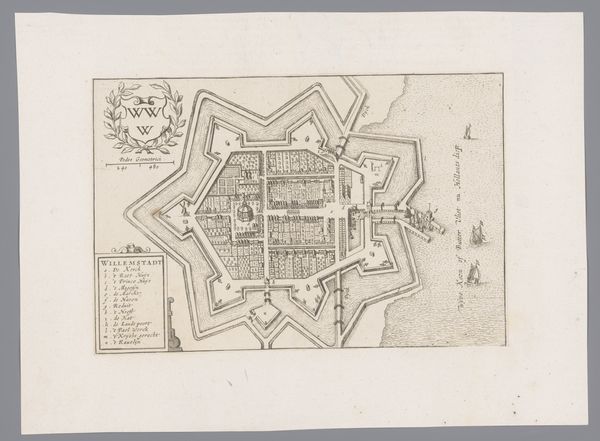
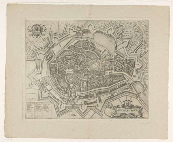
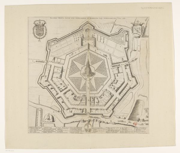
Abraham Allard created this map of Milan sometime around the turn of the 18th century, using engraving on paper. The precision of line suggests a dedicated artisan, likely trained through a formal apprenticeship. Consider how Allard had to work: carefully etching the design into a metal plate, in reverse. Every street, every building, a conscious decision made with specialized tools. The density of detail speaks to the engraver's skill, as well as the demands of the market for accurate, informative maps during this period. The work has an inherent tension between objective representation and artistic license. The engraver wasn't just documenting; they were also interpreting and shaping a vision of Milan for their audience. The map is a product of its time, reflecting the rise of cartography as both a science and a commercial enterprise. It connects to wider issues of trade, exploration, and political control. Allard's map reminds us that even seemingly straightforward images are the result of complex social and economic forces. It's more than just a picture; it's a testament to the labor and skill that went into its making.
Comments
No comments
Be the first to comment and join the conversation on the ultimate creative platform.
More like this