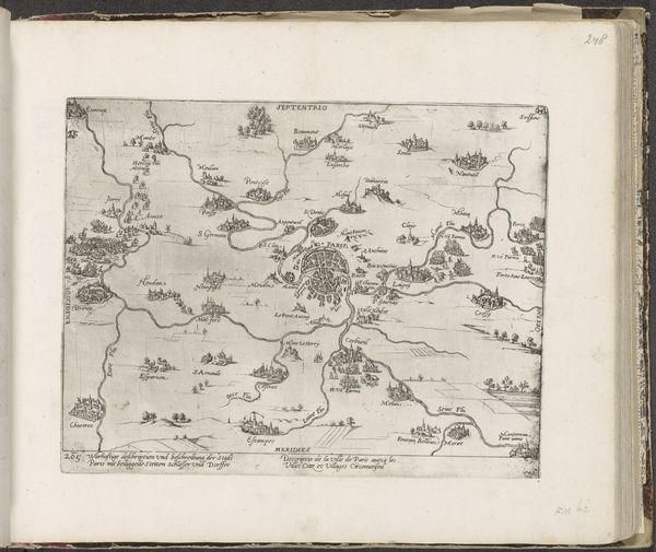
drawing, watercolor
#
drawing
#
baroque
#
landscape
#
watercolor
#
coloured pencil
#
watercolour illustration
#
watercolor
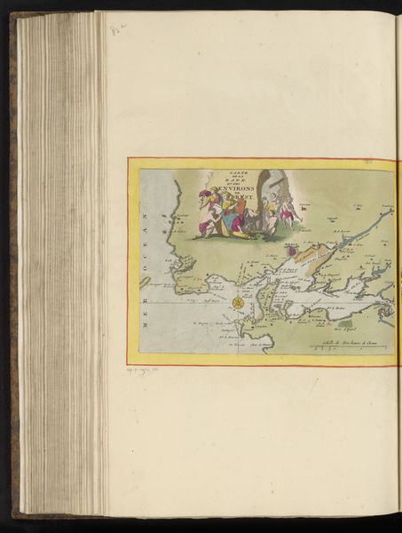
Dimensions: height 191 mm, width 273 mm, height 532 mm, width 320 mm
Copyright: Rijks Museum: Open Domain
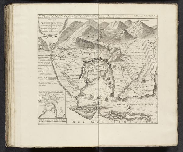
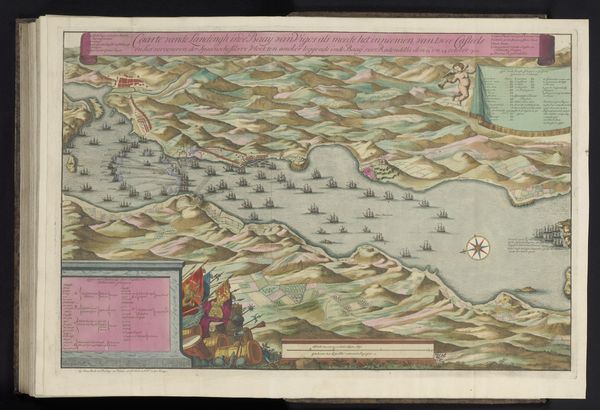
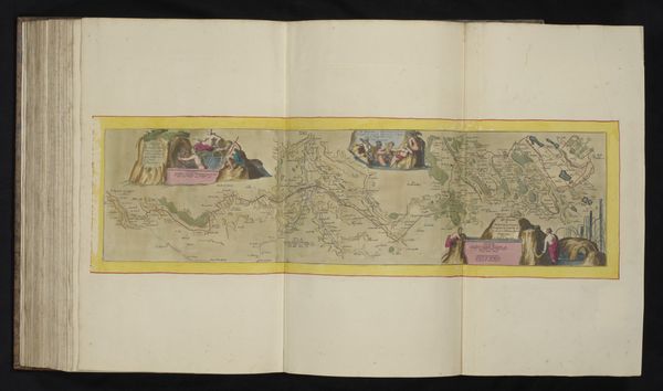
Curator: This watercolour illustration offers a cartographic perspective of Saint-Malo and its surroundings, dating back to around 1690-1700. Created by an anonymous artist, it’s a fine example of Baroque landscape drawing, now residing here at the Rijksmuseum. Editor: My first thought? A treasure map! It’s charming, the sort of image you’d expect to unfurl in a pirate’s den, all faded colours and the promise of adventure hidden among those islands. Curator: That sense of adventure is cleverly invoked through the artistry itself. Saint-Malo, as a prominent port, played a crucial role in maritime trade and, yes, even piracy. This map not only served navigational purposes, it was also likely a symbolic assertion of power and knowledge. Note how it presents a bird's-eye view, literally elevating the viewer. Editor: The water is so inviting, isn’t it? That pale blue hints at serenity, but I imagine it hid its fair share of secrets and squalls! And those meticulously rendered coastlines – I bet the artist spent hours observing the light hitting those rocks. The figures lounging at the left - perhaps imagining the riches they are to reap in the area? Curator: Precisely! They reflect the colonial aspirations of the era. Maps, then, weren’t simply geographical tools. They were instruments of empire, defining territories and influencing social power dynamics. We must also remember, for example, that the map simplifies a complex space that may look very different for the unprivileged user in the area. Editor: I hadn't thought about the inherent bias in creating and owning such depictions of the area, but it’s a critical point to consider when taking it in. From a technical perspective, I find the artist's blending of precise detail and artistic flourishes to be especially appealing, resulting in a somewhat dream-like composition despite its practical purpose. Curator: It certainly speaks volumes about how art and science converged during this period, a manifestation of power rendered beautifully. Editor: For me, it triggers the wistful desire to jump into my dinghy, follow the shores depicted in watercolour and try to experience that old world, imagining how this Saint-Malo really looked more than 300 years ago.
Comments
No comments
Be the first to comment and join the conversation on the ultimate creative platform.
More like this