graphic-art, print, engraving
#
graphic-art
#
dutch-golden-age
# print
#
landscape
#
history-painting
#
engraving
Dimensions: height 400 mm, width 507 mm
Copyright: Rijks Museum: Open Domain
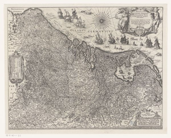
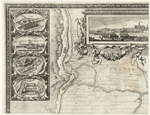
Editor: So, here we have Josua van den Enden's "Kaart van de Zeventien Provinciën," an engraving made sometime between 1608 and 1680. It’s incredibly detailed. All those tiny towns! What strikes me is how different our perception of borders and navigation must have been then. What do you see in this piece that perhaps I'm missing? Curator: Immediately, I'm drawn to the ocean. Note how the sea isn't empty. It's populated with ships, but more importantly, symbolic power. Those aren't just vessels; they represent trade, exploration, and dominion. How does this crowded sea inform your understanding of the land itself? Editor: I see what you mean. It's almost as if the sea is as important, or even more so, than the land. Like the land is just the starting point. The ships connect the provinces to the rest of the world. Curator: Exactly. And look at the compass rose. A symbol of orientation, but also destiny. The inclusion of allegorical figures and elaborate cartouches speaks volumes. What do they evoke for you? Are these aesthetic additions, or are they actively shaping how the viewer understands the map? Editor: I guess I saw them more as decorative, but now I realize they frame the whole view! The figures represent abundance and strength, projecting a certain…confidence. Almost like propaganda. Curator: Precisely! This map isn’t just a geographical tool, it’s a statement. A visual assertion of power and a shared identity that stretches beyond land, it is tied to the waters. Editor: Wow, I hadn’t thought about it that way. Now I see it isn't just about where things *are*, but also what they *mean.* Thank you! Curator: My pleasure. Every symbol tells a story, if we learn to listen.
Comments
No comments
Be the first to comment and join the conversation on the ultimate creative platform.
More like this