drawing, print, paper, ink, engraving
drawing
neoclassicism
landscape
paper
ink
engraving
Dimensions: height 200 mm, width 240 mm
Copyright: Rijks Museum: Open Domain
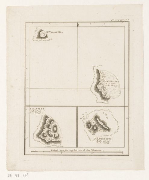
This is an anonymous map of the north side of the island of Moorea in French Polynesia. Produced during a time of intense European exploration, such maps were not simply neutral records of geography. Instead, they were tools used to claim territories, establish trade routes, and exert political control over distant lands. The very act of mapping could be seen as an assertion of dominance. Consider the perspective of the mapmaker. Was this map created from direct observation, or was it compiled from secondhand accounts? Who was the intended audience, and what purposes was the map meant to serve? Such questions can help us understand the complex power dynamics at play in the age of exploration. By examining historical documents, travelogues, and colonial records, we can gain a more nuanced understanding of how this map reflects the social, economic, and political forces of its time.
Comments
No comments
Be the first to comment and join the conversation on the ultimate creative platform.