drawing, print, ink, engraving
#
drawing
#
16_19th-century
#
neoclassicism
# print
#
pen illustration
#
old engraving style
#
ink
#
cityscape
#
engraving
Dimensions: height 333 mm, width 540 mm
Copyright: Rijks Museum: Open Domain
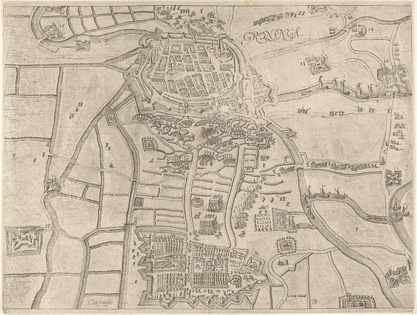
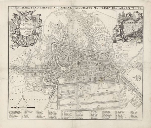
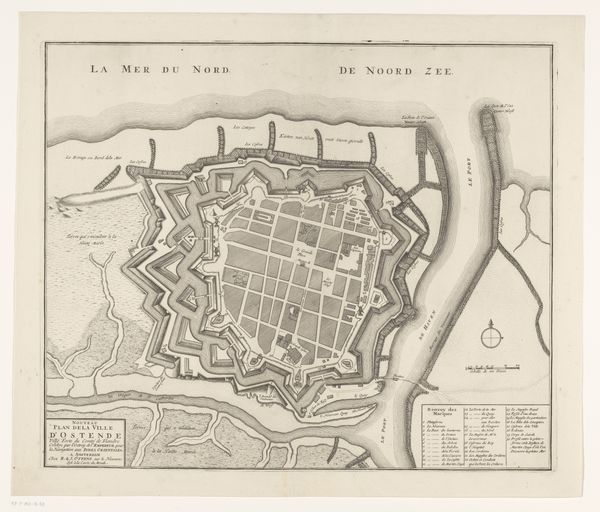
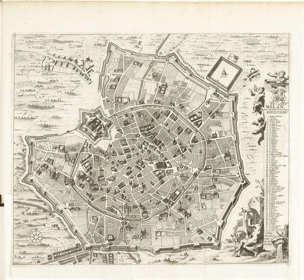
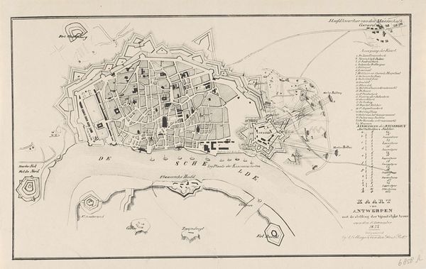
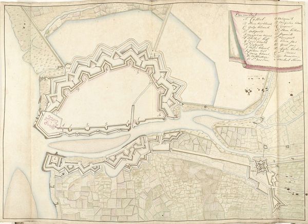
Curator: Allow me to introduce an intriguing cartographic work from 1830 titled "Plattegrond van Antwerpen en de Citadel," meaning "Map of Antwerp and the Citadel." Created anonymously, this piece employs ink and engraving to depict a bird's-eye view of the city. Editor: My first impression is one of cool precision, a sort of calm order imposed on the potential chaos of urban life. The linework is incredibly detailed, almost sterile in its perfection. It really emphasizes structure. Curator: Indeed, the very form echoes a Neoclassical desire for clarity. Note how the layout presents Antwerp. Not just as a city, but as a strategic fortress, defined by its Citadel and fortifications. One wonders about the societal anxieties underpinning such visual representation. Editor: The star-shaped Citadel certainly dominates, doesn't it? Stars have long held symbolic significance – guidance, destiny. Is the artist implying that Antwerp’s destiny is inextricably linked to its military strength and strategic importance? This form is repeated in smaller forts; there is strength in that repetition. Curator: Precisely. And consider the river Escaut, or Scheldt, flowing prominently. Water often signifies movement, trade, but here, within the context of a military map, it becomes another strategic element – a barrier, a supply line, or a route for potential invasion. The way space is divided emphasizes this tension. Editor: The close quarters of the city—so many little roofs clustered together. This speaks to the lived reality for inhabitants versus the map makers strategic, more expansive reading of the city, focused more on the starfortresses around it, and the access the Escaut offered. It’s interesting to consider whose story this map prioritizes. Curator: A vital point. This piece speaks to power dynamics of the early 19th century. This plan reflects more than geography. It presents ideology through carefully chosen lines and strategically weighted symbols, it reflects control. Editor: Well, seeing it through that lens offers a more comprehensive insight, I think, making visible how something that seems neutral – a simple map – is anything but. Curator: Yes, that's the beauty of such exploration: appreciating the artistic intention while decoding the deeper cultural meaning.
Comments
No comments
Be the first to comment and join the conversation on the ultimate creative platform.
More like this