drawing, graphic-art, print, engraving
drawing
graphic-art
baroque
pen drawing
pen illustration
pen sketch
old engraving style
pen-ink sketch
pen work
sketchbook drawing
cityscape
engraving
Dimensions: height 397 mm, width 485 mm
Copyright: Rijks Museum: Open Domain
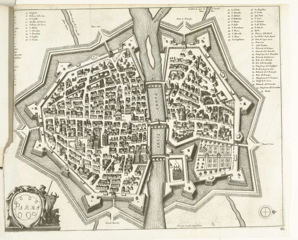
This is Isaac Basire’s “Plattegrond van Bergen (Mons),” a detailed map rendered in ink, depicting the city of Mons. What immediately strikes the eye is the city's structure, encased within a fortified perimeter that blends geometric precision with organic shapes. The intricate network of streets and buildings within the city is rendered with such detail, inviting us to explore. The surrounding fortifications, depicted as a series of angular projections, create a fascinating dialogue between order and chaos. Basire uses line work to articulate not just the physical layout of the city but also its strategic design. The composition itself seems to play with the idea of containment and expansion, the city's boundaries pushing against the natural landscape. These stark contrasts between the geometric and the organic forms creates a sense of tension, a visual representation of the city’s dual role as both a place of habitation and a site of strategic importance. The city map thus becomes a semiotic system, each line and shape encoding military, political and cultural meanings.
Comments
No comments
Be the first to comment and join the conversation on the ultimate creative platform.