About this artwork
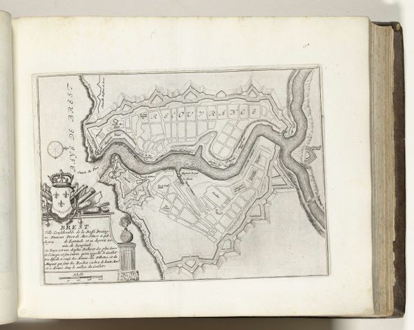
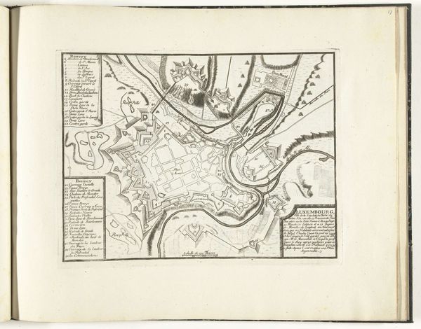
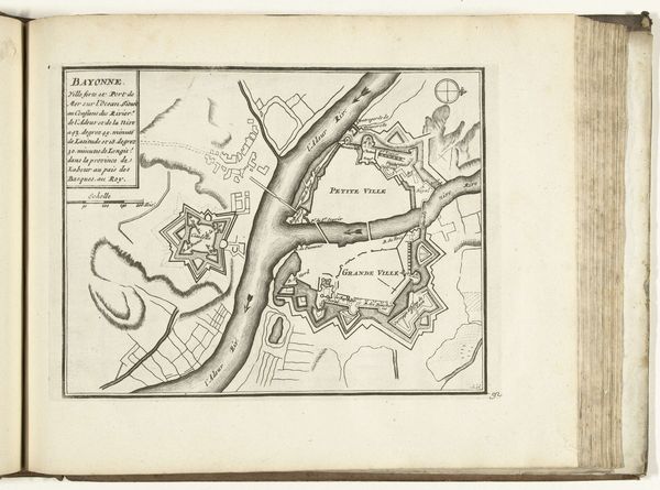
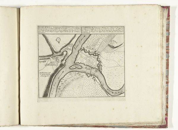
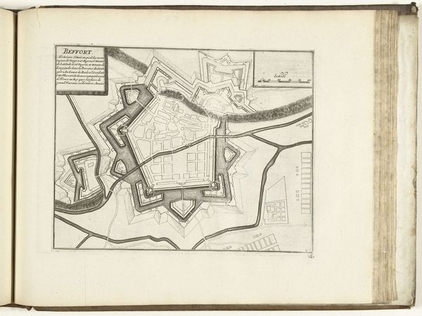
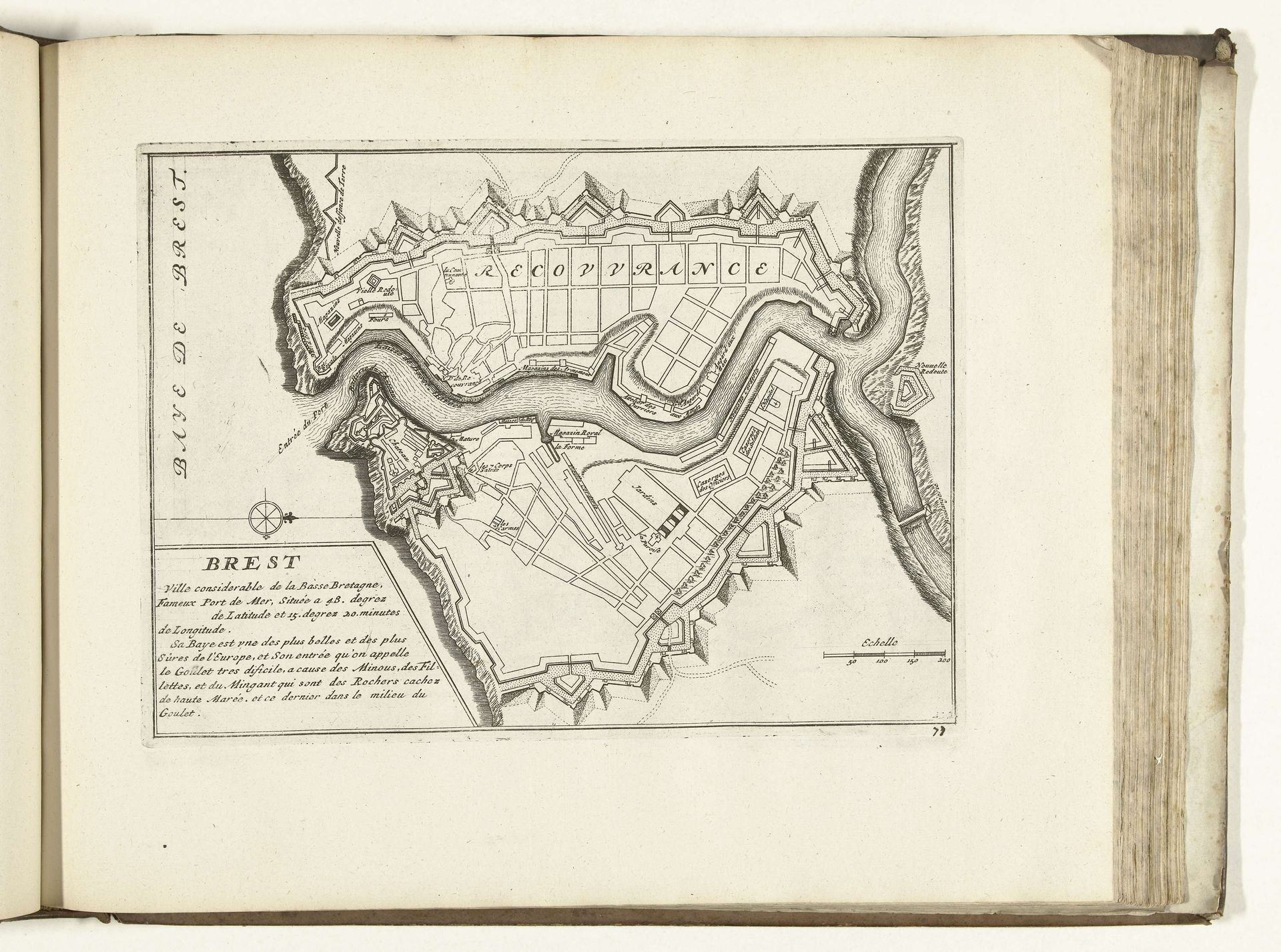
This map of Brest was made in 1726 by an anonymous artist using an engraving technique. The method involves cutting lines into a metal plate, applying ink so it fills the incisions, and using a press to transfer the image onto paper. The fine lines describe the city's architecture and fortifications. The map represents an immense amount of labor, in the surveying of the city, the drawing of the image, and the work of cutting the plate. Consider how the engraver would have used specialized tools to achieve such precision, and the skill required to visualize a three-dimensional space in two dimensions. Maps like these were not simply informational; they were tools of power, illustrating the reach of political control, and often used for military planning. The social context is thus essential to understanding the map's intention. It is an aesthetic object, yet was also conceived as a tool to aid control and governance.
Artwork details
- Medium
- drawing, ink, engraving
- Dimensions
- height 205 mm, width 282 mm
- Location
- Rijksmuseum
- Copyright
- Rijks Museum: Open Domain
Tags
Comments
Share your thoughts
About this artwork
This map of Brest was made in 1726 by an anonymous artist using an engraving technique. The method involves cutting lines into a metal plate, applying ink so it fills the incisions, and using a press to transfer the image onto paper. The fine lines describe the city's architecture and fortifications. The map represents an immense amount of labor, in the surveying of the city, the drawing of the image, and the work of cutting the plate. Consider how the engraver would have used specialized tools to achieve such precision, and the skill required to visualize a three-dimensional space in two dimensions. Maps like these were not simply informational; they were tools of power, illustrating the reach of political control, and often used for military planning. The social context is thus essential to understanding the map's intention. It is an aesthetic object, yet was also conceived as a tool to aid control and governance.
Comments
Share your thoughts