print, etching, watercolor
#
dutch-golden-age
# print
#
etching
#
old engraving style
#
landscape
#
watercolor
#
watercolour illustration
Dimensions: height 166 mm, width 150 mm
Copyright: Rijks Museum: Open Domain
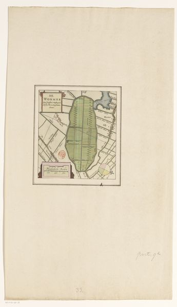
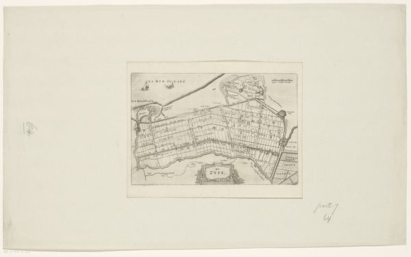
Pieter van der Keere made this map of Waterland with engraving around the turn of the 17th century. This detailed map offers more than just geographical data; it's a window into the economic and social structures of the Dutch Golden Age. The Dutch Republic was a center of cartography, driven by its maritime trade empire, and maps like these were vital for navigation and commerce, but also for establishing political claims. The image creates meaning through visual codes, cultural references, and historical associations. The detailed depiction of waterways and land divisions reflects the ongoing Dutch struggle to reclaim land from the sea. The organized grid pattern shows a society keen on control and management of resources. The historian uses the map to uncover the priorities of the society that produced it. Research into the economic policies of the Dutch Republic, and the development of cartography as a science, would further enrich our understanding of this map as a historical document.
Comments
No comments
Be the first to comment and join the conversation on the ultimate creative platform.
More like this