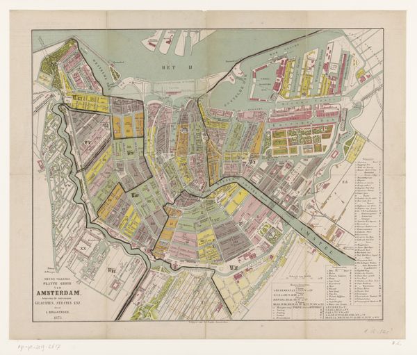
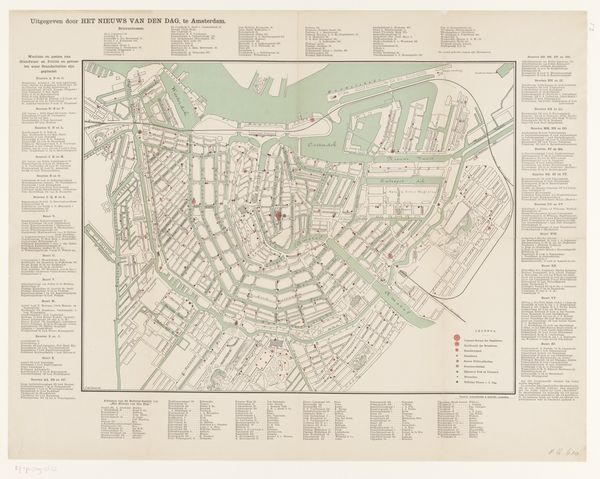
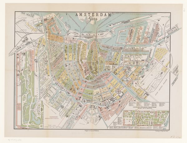
Reproductie van een plattegrond van Amsterdam met de verspreiding van trachoom in de stad 1916 - 1917
0:00
0:00
graphic-art, print
#
graphic-art
# print
#
etching
#
cityscape
#
realism
Dimensions: height 699 mm, width 830 mm
Copyright: Rijks Museum: Open Domain
This map of Amsterdam, of unknown date, uses color and form to convey the spread of trachoma in the city. The anonymous artist employs a muted palette, primarily using delicate grays to outline the city's architectural layout, allowing the red and green indicators of trachoma’s presence to stand out starkly. The composition is structured around the city’s radial canals and street grid, each building rendered with precise lines that define urban space. Yet, it is the superimposition of differently colored data points that re-interpret the existing grid. These break from the underlying uniformity to introduce a layer of social commentary through their spatial distribution. The map functions beyond mere cartography; it is a visual encoding of health statistics, merging urban planning with public health concerns. The strategic use of color creates a semiotic system that turns the map into a tool for understanding disease ecology within the city. This is more than just a visual representation. It’s a social diagnosis, a formal study of how information can reshape our perception of urban space.
Comments
No comments
Be the first to comment and join the conversation on the ultimate creative platform.
More like this