drawing, paper, ink, pen
#
architectural sketch
#
drawing
#
aged paper
#
dutch-golden-age
#
old engraving style
#
landscape
#
river
#
paper
#
personal sketchbook
#
ink
#
sketchwork
#
pen-ink sketch
#
pen work
#
sketchbook drawing
#
pen
#
cityscape
#
storyboard and sketchbook work
#
sketchbook art
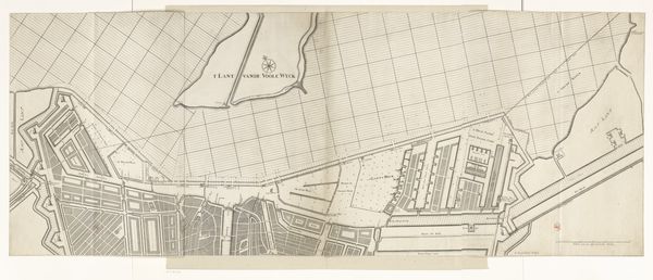
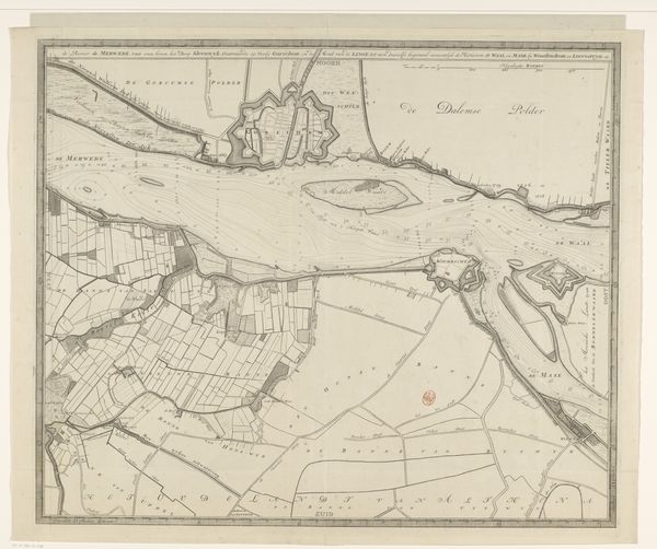
Dimensions: height 505 mm, width 706 mm
Copyright: Rijks Museum: Open Domain
This map of the IJ, made in 1674 by an anonymous artist, meticulously charts the depths near Amsterdam. Look at the structured grid of lines that dominate the composition. These lines represent a measured understanding, an effort to impose order on the natural world. The grid, as a symbol, has appeared in different contexts throughout history. In ancient Roman city planning, a similar grid-like structure symbolized dominion and organization. However, in Renaissance art, a grid might be used as a tool for perspective, a way to capture the likeness of the human form. Here, the grid's imposition on the water evokes something of the rational, scientific spirit emerging in the 17th century, connecting to a deeper, collective desire to chart and control the environment. This desire stems from the subconscious, a deep-seated need to manage the chaos of the world around us. It is a powerful, emotional engagement that resonates across time. We see it echoed in modern urban planning and digital mapping, evolving yet rooted in the same primal impulse.
Comments
No comments
Be the first to comment and join the conversation on the ultimate creative platform.
More like this