About this artwork
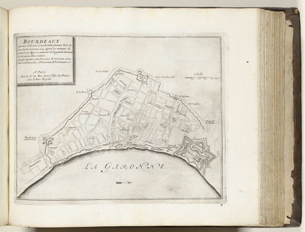
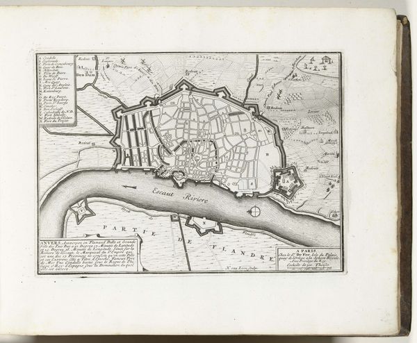
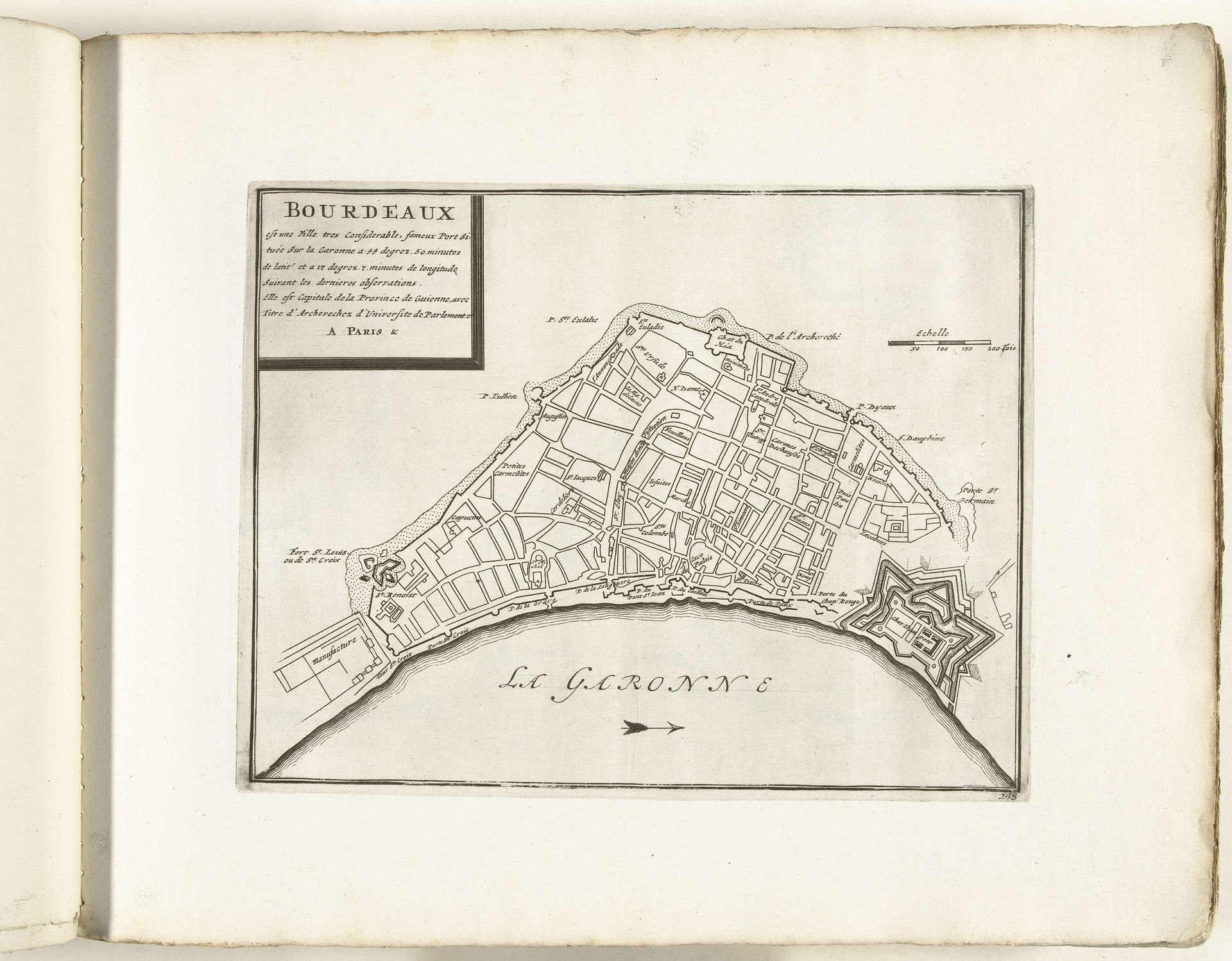
This is an anonymous map of Bordeaux, made around 1702, created through engraving. During this period, maps were not just navigational tools, they were also instruments of power, reflecting and reinforcing social hierarchies. Consider the perspective of this map – it’s an aerial view, a gaze that only those in power could truly access. The detailed depiction of the city's infrastructure and fortifications highlights the importance of military and economic control. The visual representation of Bordeaux becomes an assertion of dominance. Look at how the River Garonne, isn’t just a geographical feature, it’s a lifeline for trade and transport, essential to the city's prosperity and its role in the slave trade. What stories does the artist leave out? Who is not represented on this map? This map reflects the complex intersection of power, trade, and social structure in early 18th-century France, revealing the stories of those in control and silently marking the absence of others.
Artwork details
- Medium
- print, engraving
- Dimensions
- height 221 mm, width 285 mm
- Location
- Rijksmuseum
- Copyright
- Rijks Museum: Open Domain
Tags
geometric
line
cityscape
engraving
Comments
No comments
About this artwork
This is an anonymous map of Bordeaux, made around 1702, created through engraving. During this period, maps were not just navigational tools, they were also instruments of power, reflecting and reinforcing social hierarchies. Consider the perspective of this map – it’s an aerial view, a gaze that only those in power could truly access. The detailed depiction of the city's infrastructure and fortifications highlights the importance of military and economic control. The visual representation of Bordeaux becomes an assertion of dominance. Look at how the River Garonne, isn’t just a geographical feature, it’s a lifeline for trade and transport, essential to the city's prosperity and its role in the slave trade. What stories does the artist leave out? Who is not represented on this map? This map reflects the complex intersection of power, trade, and social structure in early 18th-century France, revealing the stories of those in control and silently marking the absence of others.
Comments
No comments