print, paper, engraving
#
dutch-golden-age
# print
#
landscape
#
paper
#
geometric
#
engraving
Dimensions: height 519 mm, width 864 mm
Copyright: Rijks Museum: Open Domain
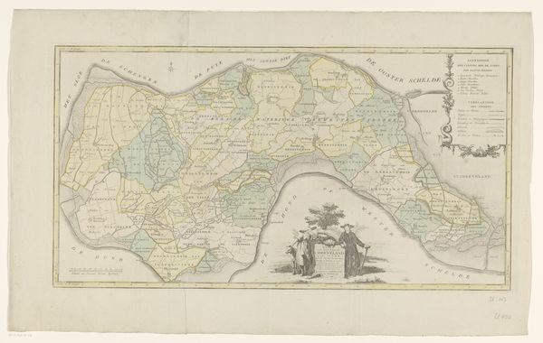
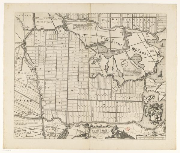
Jan Punt’s ‘Map of the Counties of Buren and Culemborg’ presents a detailed view of 18th-century Dutch geography through the precision of engraving. The cool monochrome palette emphasizes the intricate network of lines that define the landscape. Rivers meander, framing geometric partitions of land. The formal structure reveals a complex interplay between nature and human order. Text becomes a visual element, integrated within the map's design, pointing to the contemporary drive to classify and understand the world through rational means. The embellishments on the bottom right, typical of cartography of the period, are arranged to create an allegorical scene and offer a contrast to the precision and order of the counties they frame. Punt has created a complex image which reflects a moment in time where the aesthetics of art and the precision of science were combined to produce both useful and visually engaging depictions of the world.
Comments
No comments
Be the first to comment and join the conversation on the ultimate creative platform.
More like this