print, engraving
#
baroque
# print
#
geometric
#
line
#
cityscape
#
history-painting
#
engraving
Dimensions: height 423 mm, width 530 mm
Copyright: Rijks Museum: Open Domain
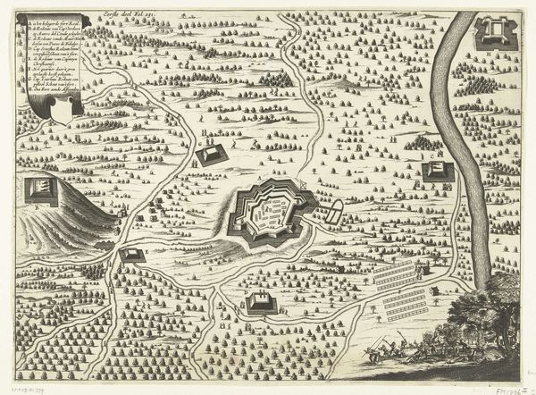
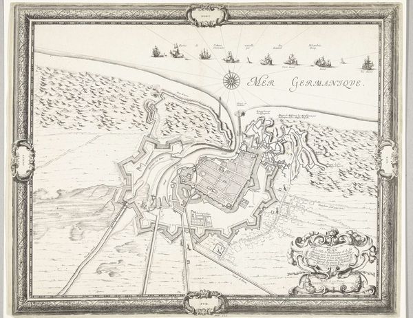
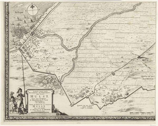
Editor: Here we have "Plattegrond van fort Mardijk, 1646," a 17th-century print, artist unknown, at the Rijksmuseum. What strikes me immediately is the geometric precision of the fort itself against the more gestural rendering of the landscape around it. What do you see in this image? Curator: What stands out to me is the symbolic language embedded within what appears to be a straightforward military map. Consider the fort's star shape, a common motif in that era. Does that form evoke anything for you beyond military strategy? Editor: I guess it suggests strength, radiating power outwards... Curator: Precisely. The star is an ancient symbol of protection and guidance, here repurposed for military might. Then consider the ships at sea. Notice how they’re labelled. Do those names carry any weight? Editor: They’re different nationalities, maybe? Suggesting a broad coalition or perhaps multiple threats? Curator: Indeed! The map isn't just documenting a place; it's constructing a narrative of geopolitical tensions. It presents a world where the Dutch Republic stands as a carefully designed bastion against a turbulent sea, both literally and metaphorically. Editor: So the image operates on multiple levels: practical, artistic, and symbolic. I’m not sure I would have picked that up on my own. Curator: That’s the beauty of iconography! We decode the visual cues to unlock layers of meaning reflecting not just an artist's intentions but entire cultural frameworks. Editor: I’ll definitely look at maps differently from now on! Thanks for highlighting how symbols shape our understanding of the world.
Comments
No comments
Be the first to comment and join the conversation on the ultimate creative platform.
More like this