print, etching, engraving, architecture
#
aged paper
#
toned paper
# print
#
etching
#
old engraving style
#
sketch book
#
etching
#
personal sketchbook
#
sketchwork
#
sketchbook drawing
#
cityscape
#
storyboard and sketchbook work
#
sketchbook art
#
engraving
#
architecture
Dimensions: height 251 mm, width 336 mm
Copyright: Rijks Museum: Open Domain
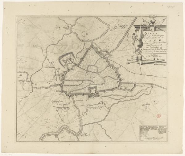
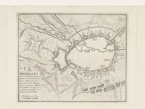
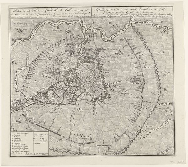
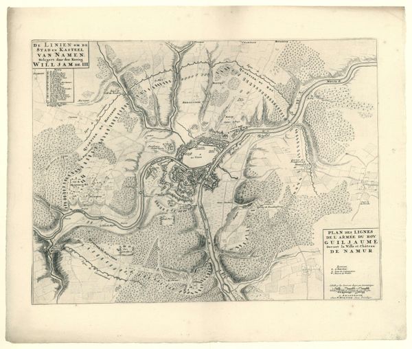
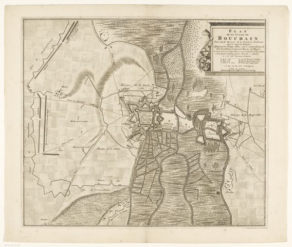
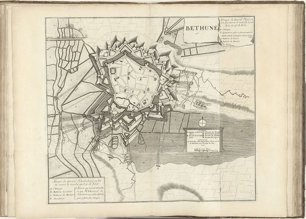
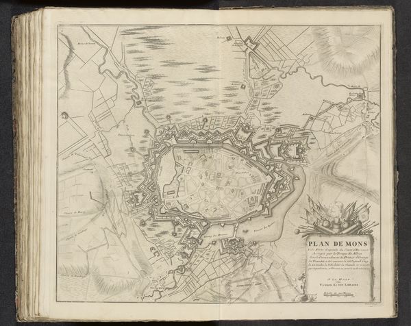
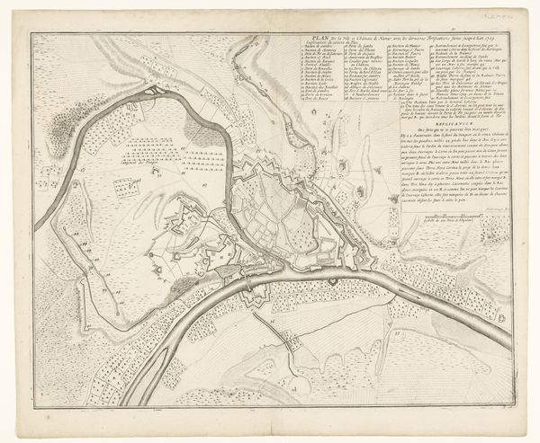
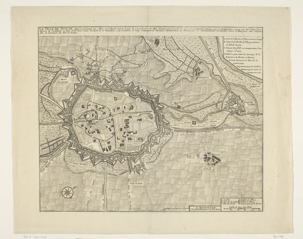
Editor: Here we have P. Starckman's "Plattegrond van Landau in der Pfalz," created sometime between 1703 and 1744, an etching and engraving. It's a city plan, quite detailed, but rendered in muted tones on aged paper. The geometric layout is fascinating. What strikes you when you look at this print? Curator: Immediately, the balanced tension between order and the organic is apparent. The sharp geometric lines of the fortified city contrast strongly with the flowing rivers and the rough terrain surrounding it. The use of line becomes the primary focus; notice how the artist meticulously renders the textures of the land versus the rigid structures of the architecture. Editor: So, it's really the relationship between those contrasting lines that makes it interesting? Curator: Precisely. Note how the circular fort anchors the composition. Its very structured form commands visual hierarchy, with linear projections dissecting the organic terrain, while simultaneously integrating with it, through the etching's tonal qualities that blend structure and terrain in an all-over composition. Do you notice how the key uses the same kind of line but this time to denote meaning? Editor: Yes, now that you mention it, the ordered lines describing built environments versus wild areas of nature do highlight an order. What do you mean when you refer to tone? Curator: Tone concerns itself with relationships between black and white and the spectrum of greys produced as they interact across the aged surface, here the tonality produces mood and depth which gives equal weight to both landscape and architecture.. Editor: I see what you mean! I hadn't considered how the artist used line and tonal values in this way to direct our attention. It definitely reveals new perspectives beyond just the historical document. Curator: Yes, precisely. By emphasizing these formal relationships, we understand how visual choices reflect deeper underlying frameworks.
Comments
No comments
Be the first to comment and join the conversation on the ultimate creative platform.
More like this