print, engraving
#
dutch-golden-age
# print
#
line
#
cityscape
#
history-painting
#
engraving
#
watercolor
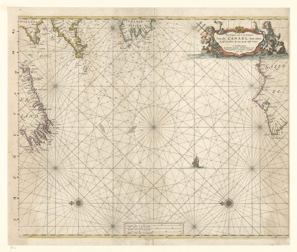
Dimensions: height 440 mm, width 535 mm
Copyright: Rijks Museum: Open Domain
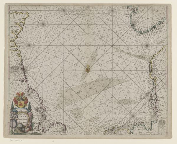
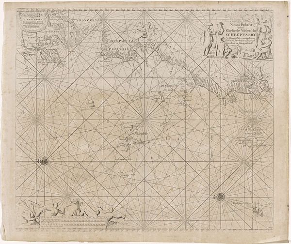
Editor: We’re looking at a detailed “Zeekaart van de zee ten westen van Ierland,” a marine chart of the seas west of Ireland created sometime between 1658 and 1670 by Hendrick Doncker. It's a print, an engraving really, meticulously hand-colored. It’s striking how vast and empty the ocean feels, almost like the landmasses are just clinging on. What strikes you about this piece? Curator: Ah, the siren song of the sea! You're right, there's a palpable tension between the known and the unknown, isn't there? The tightly gridded lines—those are rhumb lines, tools for navigation, whispering promises of safe passage—yet the swirling shapes of the coastlines hint at danger and mystery. Notice the tiny ships scattered, mere toys on this immense watery stage, brave but fragile, each driven by human endeavor to understand their world. They are all on the mercies of currents, tempests, and gods of the deep. And did you spot the cartouche down in the corner? That little vignette, the engraver diligently working—it grounds the entire map, reminds us of the human hands, the sheer labor and vision, behind its creation. The map becomes something far grander and more meaningful that simple route guidance. Editor: I hadn't really focused on the cartouche, but I see what you mean. The ships felt decorative to me, I was stuck in that headspace, rather than the map being the representation of real danger and trade. So it's not just a chart, it’s almost like a statement? Curator: Exactly! It's a testament to human curiosity, to our desire to map the world around us and stake our claim on it. How do you feel about this now? Editor: I definitely look at it differently. It makes you appreciate all those elements, that aren't immediately apparent! Curator: Yes. It is a good reminder to never underestimate the power of close observation and reflection, right?
Comments
No comments
Be the first to comment and join the conversation on the ultimate creative platform.
More like this