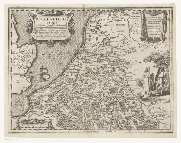
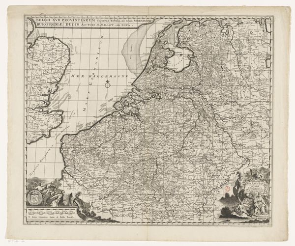
Kaart van de Republiek der Zeven Verenigde Nederlanden en omliggende gebieden 1707
0:00
0:00
pieterimortier
Rijksmuseum
graphic-art, print, engraving
#
graphic-art
#
baroque
# print
#
landscape
#
geometric
#
history-painting
#
decorative-art
#
engraving
Dimensions: height 484 mm, width 619 mm
Copyright: Rijks Museum: Open Domain
Curator: Pieter Mortier’s "Kaart van de Republiek der Zeven Verenigde Nederlanden en omliggende gebieden" from 1707. It's an engraving, offering a detailed view of the Dutch Republic. What's your immediate impression? Editor: Stark. The lines are so clean and deliberate, aren't they? You immediately get the sense of political borders, of a controlled and defined space, and all its socio-economic structures as a consequence. Curator: Absolutely. Considering Mortier was a prominent cartographer and printmaker, the means of production here are vital. This map wasn't just about geographical accuracy; it was about reinforcing Dutch identity and projecting power. The act of engraving itself allowed for mass production and distribution, embedding this image into the collective consciousness. Editor: Right. Look at the ornamental details – the coats of arms, the allegorical figures. These are deliberately placed markers, not just decorative but serving to legitimize authority and national identity. This isn't merely about topography; it’s a statement of self-affirmation at a key period in early modern European history. And think about who this map was intended *for*. "Ad usum Serenissimi Burgundie Ducis"—for the use of the Most Serene Duke of Burgundy. Curator: Good point. And the details, crafted through laborious engraving techniques, showcase the commercial sophistication of Dutch printmaking at the time. The materiality is also very important because of what a mass-produced print entails for public knowledge, for national and international economic growth in printmaking workshops and cartographic projects that become increasingly globalized through trade circuits, impacting the way this knowledge could reach other populations around the world. Editor: That's interesting! It reveals the map was in circulation across Europe’s political structures, perhaps, as evidence, not just for navigation or geographical knowledge. The very act of its creation and ownership serves political strategies and social negotiation. Curator: Precisely. These weren't merely tools for travelers but objects deeply embedded within the fabric of political and economic life. By looking at the processes involved, and at the same time considering it in the cultural milieu, we get closer to this historical meaning-making. Editor: Seeing this map, for me, creates the bridge between aesthetics and practical function. Now I also see how it intersects with political power, national identity, and also serves propaganda! Curator: Precisely, seeing its materiality and method of construction really does allow the understanding of its wide reach, while, yes, still reflecting the biases that surround it.
Comments
No comments
Be the first to comment and join the conversation on the ultimate creative platform.
More like this