About this artwork
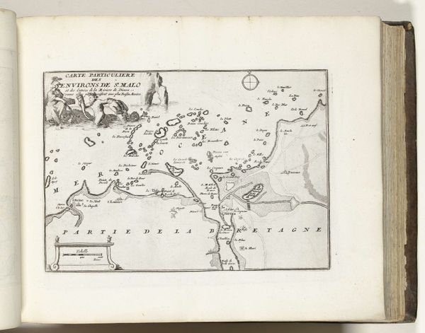
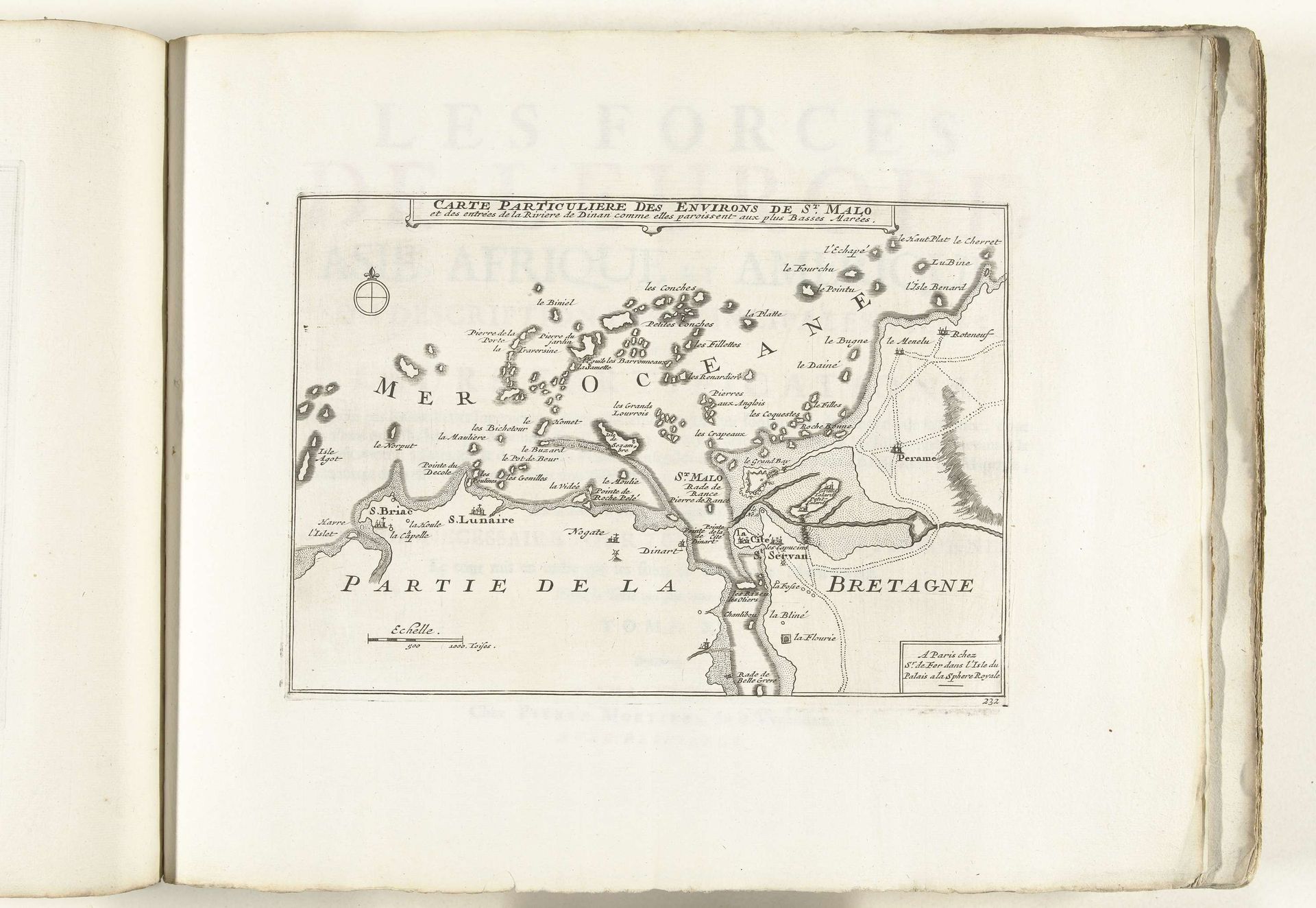
This map of Saint-Malo and the surrounding area was made around 1702 by an anonymous artist, and rendered in ink. What is the public role of a map? One answer might be to enable governance, to delineate property, or to facilitate the movement of goods and people. As a port city in Brittany, Saint-Malo had economic and strategic importance. Note how the map emphasizes the coastline and the islands, providing detailed information for navigation. But maps also function as tools of power. In early modern Europe, cartography was closely tied to statecraft and military strategy. Accurate maps were essential for projecting power, both domestically and in overseas expansion. Examining sources in state archives helps us understand how maps played a part in shaping the political landscape. Ultimately, the meaning of this map is contingent on its social and institutional context, which we can discover through careful historical research.
Kaart van Saint-Malo en omgeving, ca. 1702 1702 - 1703
Anonymous
@anonymousLocation
RijksmuseumArtwork details
- Medium
- drawing, print, engraving
- Dimensions
- height 193 mm, width 276 mm
- Location
- Rijksmuseum
- Copyright
- Rijks Museum: Open Domain
Tags
drawing
pen sketch
old engraving style
geometric
history-painting
engraving
Comments
No comments
About this artwork
This map of Saint-Malo and the surrounding area was made around 1702 by an anonymous artist, and rendered in ink. What is the public role of a map? One answer might be to enable governance, to delineate property, or to facilitate the movement of goods and people. As a port city in Brittany, Saint-Malo had economic and strategic importance. Note how the map emphasizes the coastline and the islands, providing detailed information for navigation. But maps also function as tools of power. In early modern Europe, cartography was closely tied to statecraft and military strategy. Accurate maps were essential for projecting power, both domestically and in overseas expansion. Examining sources in state archives helps us understand how maps played a part in shaping the political landscape. Ultimately, the meaning of this map is contingent on its social and institutional context, which we can discover through careful historical research.
Comments
No comments