print, etching, engraving
#
baroque
# print
#
etching
#
etching
#
history-painting
#
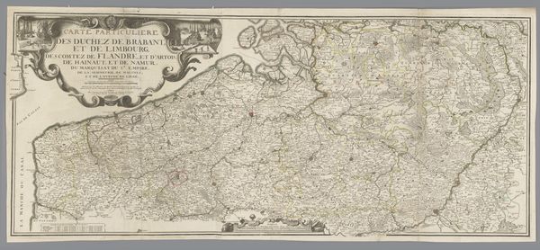
engraving
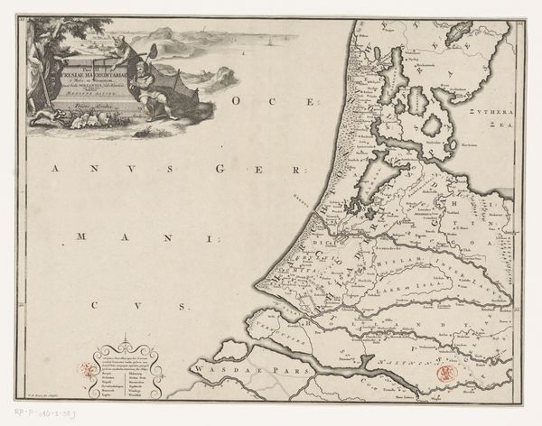
Dimensions: height 204 mm, width 268 mm
Copyright: Rijks Museum: Open Domain
This map of part of the Austrian Netherlands was made by Tobias Conrad Lotter, probably around the mid-18th century. It’s an engraving, meaning that the image was incised into a metal plate, likely copper. The plate would have been inked and then pressed onto paper. Look closely, and you can see the fine lines that define the coast, the cities, and the elaborate cartouche with its wind-blowing cherubs. The engraver needed a very steady hand and an intimate knowledge of the region – and a great deal of time. This wasn’t a quick process. Prints like this were luxury goods, prized for their accuracy, their aesthetic refinement, and the knowledge they conveyed. The map speaks to a culture of exploration, trade, and the rise of scientific understanding – all enabled by skilled hands making marks on metal. So, next time you see a map, remember the labor involved in its creation.
Comments
No comments
Be the first to comment and join the conversation on the ultimate creative platform.
More like this