print, engraving
# print
#
landscape
#
geometric
#
cityscape
#
engraving
Dimensions: height 118 mm, width 141 mm
Copyright: Rijks Museum: Open Domain
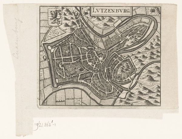
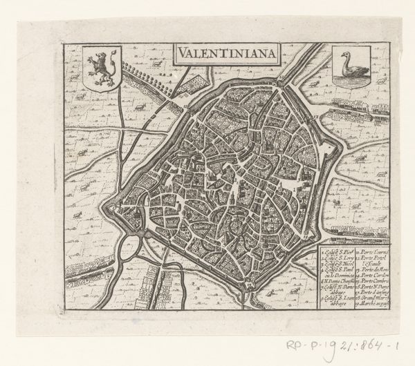
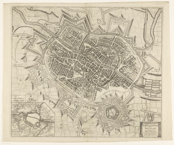
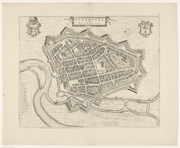
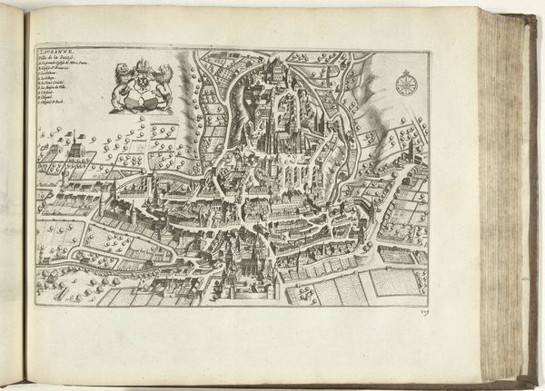
Curator: Looking at this print from 1652, currently residing in the Rijksmuseum, we see the "Plattegrond van Namen," a meticulously detailed map of the city. Editor: My first impression is how contained and orderly everything appears. The rigid geometric shapes forming the town feel incredibly strategic and...almost sterile. Curator: Well, it reflects the socio-political reality of the time. Cities were fortresses, constantly vulnerable to siege. Maps like these were crucial military and administrative tools. We can observe how the town has been built strategically alongside rivers that would have aided the movement of goods as well as protecting them from enemies on all sides. Editor: Absolutely, I see that now. Form follows function here; there are aesthetic choices influenced by political necessities. But consider the lines: The engraver used incredibly precise, sharp lines to delineate walls, streets, and even individual buildings. Note also how effectively it evokes depth using hatching techniques to distinguish textures between fields, rivers, and the dense urban area. Curator: The level of detail would also serve to impress; mapping as a way of signifying power. Control of land, resource management and even exerting symbolic control over territory were deeply enmeshed. Consider the placement of key buildings—marked on the legend. Churches and possibly administrative centres denoted spiritual and secular rule in society at the time. Editor: True. The cartographer effectively used textual annotation too. That tiny block of keys serves as this practical method for orientation that actually pulls me into understanding this space. It adds another layer of interpretation for a seventeenth-century person interacting with this print versus now. Curator: Exactly. For the contemporary viewer in 1652, such precision spoke directly to the promise of stable rule but to those with competing claims for rule, these symbolic choices may suggest attempts to secure their political claims about sovereignty in times of warfare for this border town. Editor: That interplay of careful craftsmanship and geopolitical undertones creates a striking paradox—an attempt for absolute clarity but with potential underlying agenda. It prompts one to consider how perspective in even a 'factual' document is anything but value neutral. Curator: Indeed. Examining this map through a historical lens deepens our awareness. Visual depiction doesn’t merely imitate objective reality but shapes it. Editor: From a formal point of view, what at first looked solely like documentation proves a potent visual construct in and of itself. It blends both form and symbolic order so seamlessly, urging you to keep looking to resolve that interplay.
Comments
No comments
Be the first to comment and join the conversation on the ultimate creative platform.
More like this