drawing, print, engraving, architecture
#
drawing
#
baroque
# print
#
cityscape
#
engraving
#
architecture
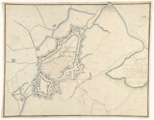
Dimensions: height 530 mm, width 730 mm
Copyright: Rijks Museum: Open Domain
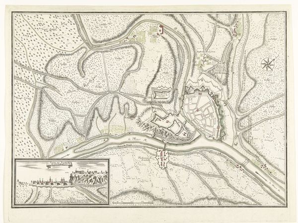
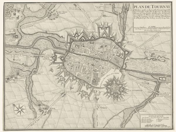
Editor: This is "Plattegrond van Namen," a print and drawing by Nicolas Suly from the early 18th century. It’s a baroque cityscape, almost like a bird's-eye view. It feels incredibly precise and detailed, yet slightly detached from the reality of life in the city. What do you see in this piece? Curator: Immediately, I’m drawn to the strategic presentation of the city. The intricate fortifications, resembling geometric patterns, speak volumes about the cultural anxieties of the time – constant threat, boundaries defined by military strategy. The radiating lines of defense become symbols themselves, warding off not just physical invaders, but also the chaos of the unknown. Do you notice how the natural landscape is subservient to the imposed order of the fortifications? Editor: Yes, the forts definitely dominate the view. The river and surrounding land seem almost secondary, arranged around those star-shaped structures. Does the rendering style give clues? Curator: Absolutely. The sharp, precise lines emphasize control and a desire for rational understanding. It’s not just about showing Namur, but about mastering it, containing it within a visual framework. Think about the power dynamics embedded in the act of mapping itself – to map is to claim, to understand, to potentially control. Does that change your interpretation at all? Editor: Definitely. It shifts my focus from just seeing a city to considering how it was being perceived and controlled, or at least how the powerful wanted it to appear. It feels almost like propaganda disguised as cartography. Curator: Precisely. This blend of utility and veiled ideology highlights the fascinating way images serve as cultural touchstones, embedding values and reinforcing societal structures long after their creation.
Comments
No comments
Be the first to comment and join the conversation on the ultimate creative platform.
More like this