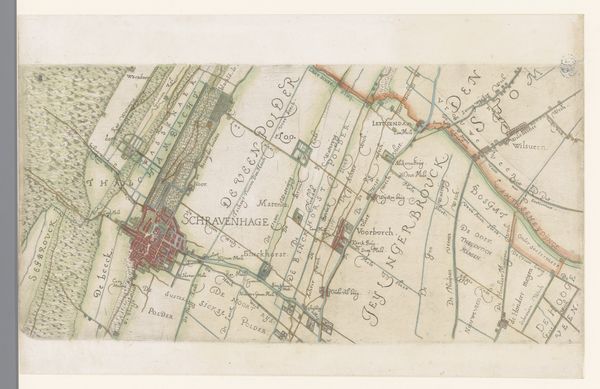
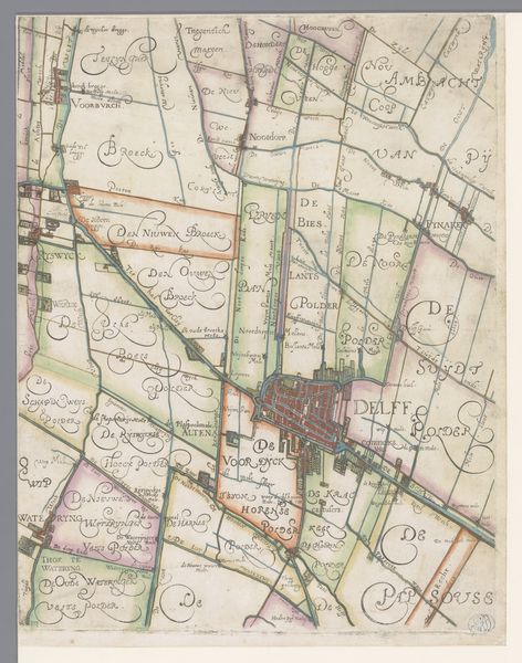
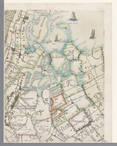
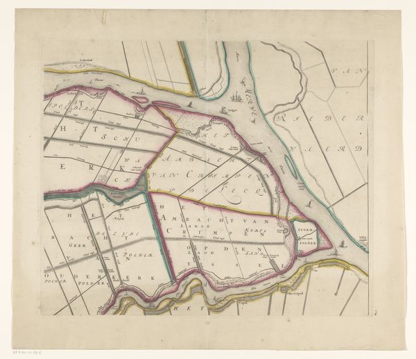
Deel van een kaart van het Hoogheemraadschap van Rijnland, met Wassenaar en omgeving 1615
0:00
0:00
florisbalthasarszvanberckenrode
Rijksmuseum
drawing, print, etching
#
drawing
#
dutch-golden-age
# print
#
etching
#
landscape
#
etching
Dimensions: height 364 mm, width 274 mm
Copyright: Rijks Museum: Open Domain
Curator: This is “Part of a Map of the Water Board of Rijnland, with Wassenaar and Surroundings,” a 1615 etching and print by Floris Balthasarsz van Berckenrode, housed here at the Rijksmuseum. Editor: It’s fascinating! So much detail rendered with what must have been quite rudimentary technology, especially when you think about the human labor that went into surveying and drafting. I am wondering, from your perspective, what is the most striking aspect of this piece? Curator: What stands out to me is how this map functions not just as a representation of land, but as a document of its management. Look at the meticulous delineation of waterways and polder systems. Editor: The sheer amount of labor dedicated to etching all of the individual streams must have been considerable. Curator: Exactly! We often consider landscape paintings as aesthetic objects, but this challenges that separation. It portrays nature heavily mediated through human labor and engineering, and, in its own way, this is just as 'constructed' as any traditional artwork. The material reality of land reclamation and maintenance in the Dutch Golden Age is brought to the forefront, foregrounding how resources are distributed through those various small square plots. Do you think this challenges the notion of the "artist" as someone separate from this wider scope of societal work? Editor: Absolutely. It underscores how artistic skills like drafting and engraving were embedded in practical, economically crucial activities. The creation of the map itself reflects a social transaction! Curator: Indeed, this reminds us that art objects are also records of resource extraction, technical skill, and socio-economic relationships of their time. Thinking about how that map was drafted by hand transforms the way we see even simple marks that could now be reproduced so efficiently with modern technologies. Editor: That reframing gives the artwork a far broader dimension, which provides a totally different meaning than considering it as just decorative or documentary!
Comments
No comments
Be the first to comment and join the conversation on the ultimate creative platform.
More like this