drawing, paper, ink
#
drawing
#
landscape
#
paper
#
ink
#
history-painting
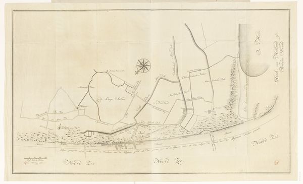
Dimensions: height 276 mm, width 406 mm
Copyright: Rijks Museum: Open Domain
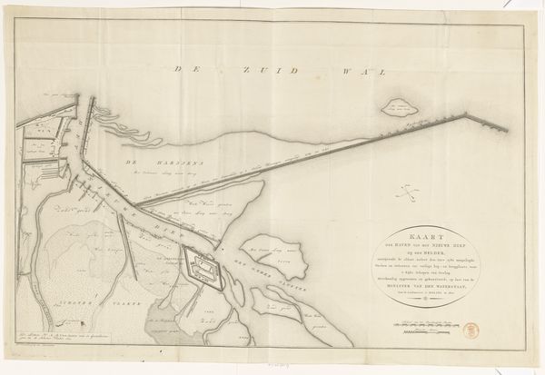
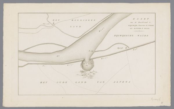
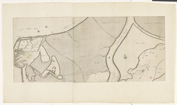
Curator: Looking at this work, “Kaart van dijkdoorbraak in de Bommelerwaard, 1809,” we see a depiction, rendered in ink on paper, mapping the levee breach in Bommelerwaard, created in 1809 by an anonymous artist. What is your initial take? Editor: A topographical drawing! It evokes the calm before the storm, so to speak. There's a strange peace to this ordered chaos. The precision highlights the disruption caused by something natural and unavoidable; a disaster laid bare as a quiet story on paper. Curator: Precisely. The calm presentation is quite characteristic for the period; it represents an attempt to document and understand the consequences of a natural disaster within the framework of the existing political and social structure. Notice the clear labeling, essential to Dutch administration, to give order to a region thrown into chaos. Editor: Yes, it's as if to say, “Even chaos can be measured, categorized, and therefore, controlled." But can we ever control water? It is rendered so gently here with simple, light ink. The blank space surrounding it almost swallows it up. Curator: Control was indeed the objective, certainly in the 19th century, in an effort to learn how to avoid the breaches in the future. The disaster becomes data. History is recorded in this objective rendering. The map gives insight into land usage, river flows, all the vital infrastructure destroyed, to give context and clarity for future mitigation and political awareness of flood impact. Editor: I like that idea, "Disaster as data”. Because viewed now, it’s as if the map holds a secret language, where the thin lines represent fragile, watery barriers between life and submersion, prosperity, and poverty. It’s haunting. Curator: Ultimately, works like this highlight a moment where nature confronted society head-on. They serve as powerful testaments to the enduring battle between human efforts and the sheer force of natural events. Editor: Right, and maybe an artist's reminder of nature's enduring power to inspire a sense of melancholy and profound, reflective observation. A quiet but haunting study!
Comments
No comments
Be the first to comment and join the conversation on the ultimate creative platform.
More like this