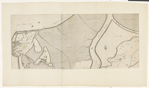
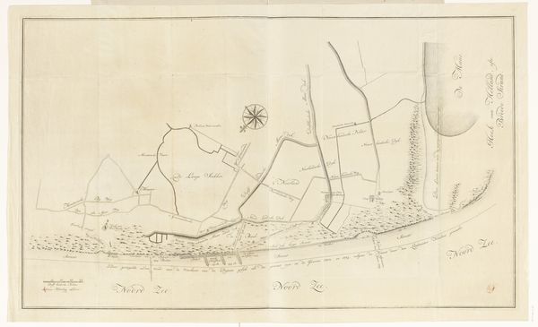
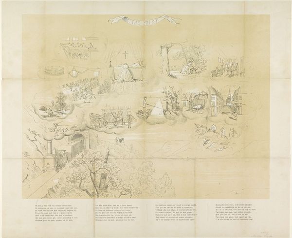
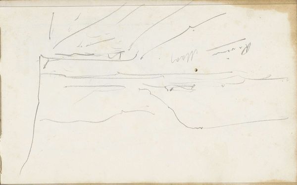
Kaart van het gebied rond de Rijn, van het veer bij Malburgen tot aan Spijk (Rijnwaarden) 1807
0:00
0:00
danieliveelwaard
Rijksmuseum
drawing, print, paper, ink
#
drawing
#
neoclacissism
#
light pencil work
# print
#
sketch book
#
hand drawn type
#
landscape
#
river
#
paper
#
personal sketchbook
#
ink
#
sketchwork
#
ink drawing experimentation
#
pen-ink sketch
#
sketchbook drawing
#
storyboard and sketchbook work
#
sketchbook art
Dimensions: height 430 mm, width 1073 mm
Copyright: Rijks Museum: Open Domain
Curator: Let's turn our attention to this detailed map from 1807. It's titled "Kaart van het gebied rond de Rijn, van het veer bij Malburgen tot aan Spijk (Rijnwaarden)," created by Daniël (I) Veelwaard. It’s currently held in the Rijksmuseum. Editor: My first impression is how delicate it appears. The lines are so fine, like a spiderweb laid over the land. You can almost feel the care in the draftsmanship. What medium did Veelwaard employ? Curator: It’s primarily ink and pencil on paper, enhanced through printmaking techniques. Maps like these served a vital function; they weren't just representations but tools for governance and military strategy. The Rhine was a crucial artery. Editor: Absolutely. Think of the paper itself, though – probably linen-based, meticulously prepared. The ink, carefully mixed, perhaps with specific binders to adhere perfectly to the surface. This speaks to the artist's engagement with available material culture, connecting artisanal practice to geopolitical imperative. Curator: It is interesting to view through that lens, but look closer at how the geography is rendered – almost neoclassical in its pursuit of order and clarity. See how settlements and waterways are carefully labeled, all conforming to established cartographic conventions. Editor: But even in conforming, he exerts control. Notice the hand-drawn type and the sheer manual labor required to execute the piece, especially if you think of this process multiplied in a workshop context for different commissioning authorities. We must consider this as both representation and a result of considerable effort from human bodies. Curator: True, and the circulation of prints like this shaped public perception of territory and nationhood. By disseminating these images, governments projected their power and legitimacy. It’s very deliberate image construction that helped support their territorial ambitions. Editor: So while on the surface we have what appears to be merely an objective survey, that objectivity is deeply embedded with social relationships— between patron, map-maker, and those being surveyed. The materials become active agents in those exchanges. Curator: Viewing it through both lenses provides a richer understanding, don't you think? It highlights the intricate relationship between artistic expression, technological processes, and socio-political realities. Editor: Agreed. It shifts the conversation from simply “art” to considering the complex ecosystem in which it was created, viewed, and circulated.
Comments
No comments
Be the first to comment and join the conversation on the ultimate creative platform.
More like this