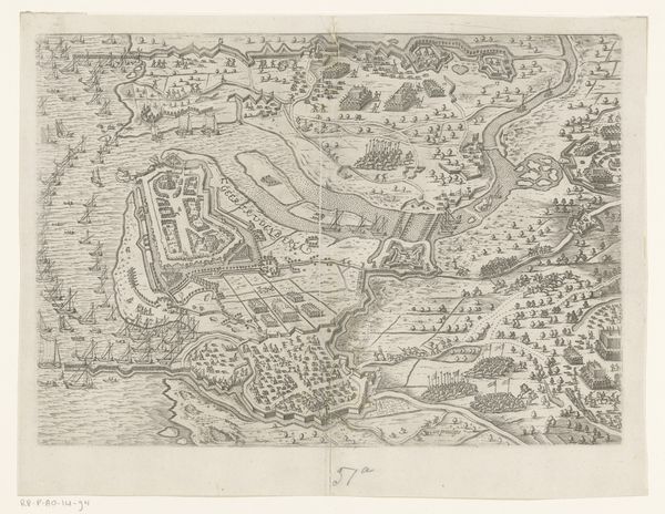
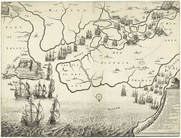
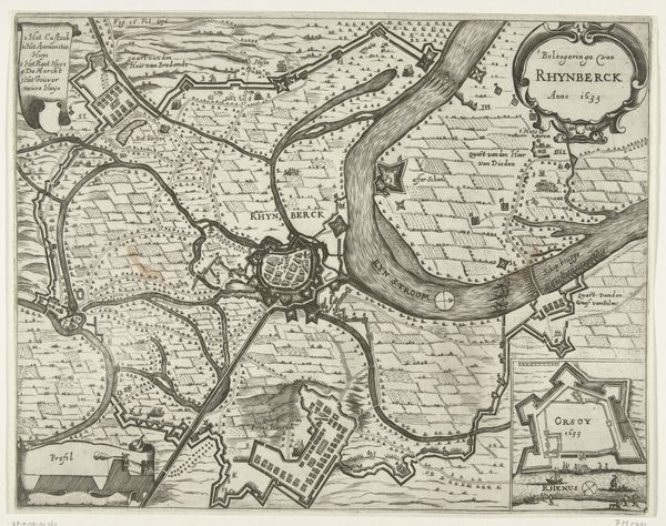
Tocht van het leger van Maurits naar Oostende (linkerblad), 1600 1600 - 1601
0:00
0:00
florisbalthasarszvanberckenrode
Rijksmuseum
print, engraving
#
dutch-golden-age
# print
#
landscape
#
cityscape
#
engraving
Dimensions: height 415 mm, width 530 mm
Copyright: Rijks Museum: Open Domain
Editor: Here we have Floris Balthasarsz van Berckenrode's engraving, "Tocht van het leger van Maurits naar Oostende," created around 1600. The sheer density of detail is impressive. It's almost overwhelming at first glance. What are your thoughts on this detailed cityscape? Curator: This work serves as a potent reminder that cartography isn't just about geography; it's a deliberate act of constructing power and shaping narratives. What was at stake when this map was created? Who was Berckenrode addressing? Editor: Well, it depicts Maurice of Nassau's army en route to Ostend. So, likely aimed at demonstrating Dutch military strength during the Eighty Years' War? Curator: Exactly. Consider this 'landscape' through the lens of Dutch identity formation. It’s visualizing national aspirations during a time of intense socio-political upheaval. How does the strategic placement of elements – like the fleets, fortifications, or text cartouches – contribute to a dominant narrative? Editor: It certainly projects power. The detailed ships and fortified positions seem to highlight military prowess, visually emphasizing control over territory and trade routes. Is the visual prominence intended to convey a message about Dutch power, perhaps in response to Spanish control? Curator: Precisely! Look closely – notice any areas underrepresented or minimized? Whose stories might be missing or deliberately silenced in this depiction? What might those omissions tell us about the politics of representation in that era? Editor: That’s a very helpful viewpoint to adopt. Thinking about whose perspectives aren’t included definitely shifts my understanding of the work. I suppose all depictions of power are inherently subjective and strategically selective. Curator: Precisely. And recognizing that inherent subjectivity allows us to engage more critically with these visual records. Maps like these shaped not just geographical understanding, but also collective consciousness.
Comments
No comments
Be the first to comment and join the conversation on the ultimate creative platform.
More like this