print, etching, engraving
# print
#
etching
#
landscape
#
etching
#
pen-ink sketch
#
history-painting
#
engraving
Dimensions: height 450 mm, width 531 mm
Copyright: Rijks Museum: Open Domain
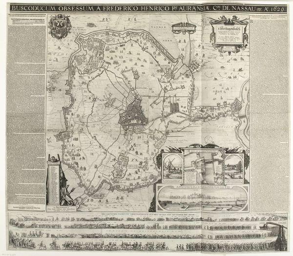
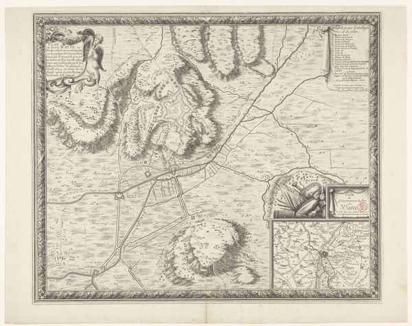
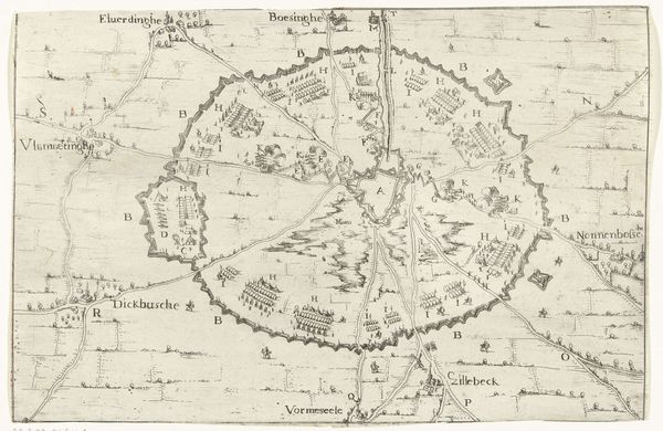
This is Loisel’s map, illustrating the siege of Ath in 1697, rendered with ink on paper. The bird's-eye view includes detailed fortifications, troop movements, and strategic positioning. Notice the marching soldiers, a recurring motif throughout history. From the Roman legions depicted on Trajan's Column to the revolutionary armies in Delacroix’s Liberty Leading the People, the marching figure is a powerful symbol of collective will and purpose. Yet, its meaning has evolved. In ancient Rome, it signified imperial might; during the French Revolution, it represented popular uprising. These shifting interpretations underscore the complex interplay between cultural memory and the present. The sight of marching soldiers evokes a sense of order, power, and perhaps, an unconscious fear of collective force. It taps into a primal understanding of human organization and its capacity for both construction and destruction. It triggers visceral responses, linking viewers to ancestral memories of conflict, survival, and the eternal human drive for dominance and belonging.
Comments
No comments
Be the first to comment and join the conversation on the ultimate creative platform.
More like this