Plattegronden van Luxemburg, Thionville, Montmédy en Damvillers, ca. 1702 1702 - 1703
0:00
0:00
laurensscherm
Rijksmuseum
drawing, paper, ink, pen
#
drawing
#
baroque
#
pen sketch
#
paper
#
ink
#
geometric
#
pen
#
cityscape
Dimensions: height 234 mm, width 343 mm
Copyright: Rijks Museum: Open Domain
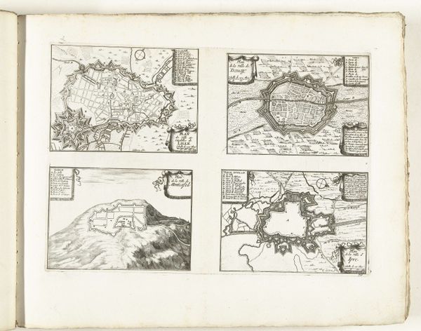
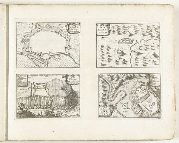
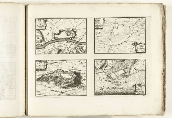
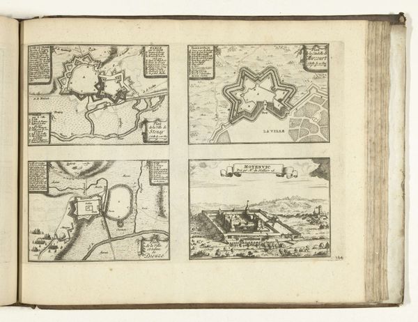
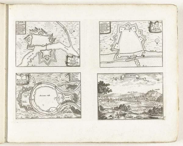
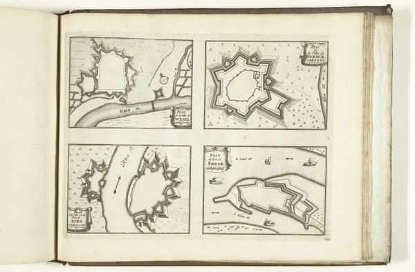
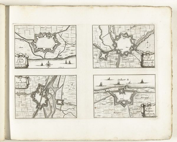
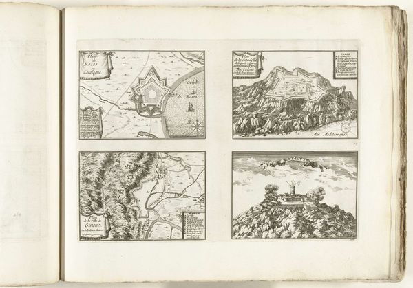
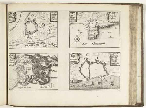
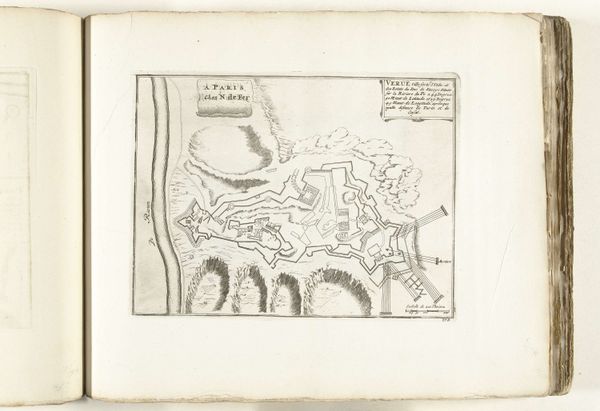
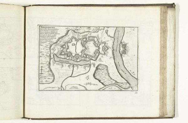
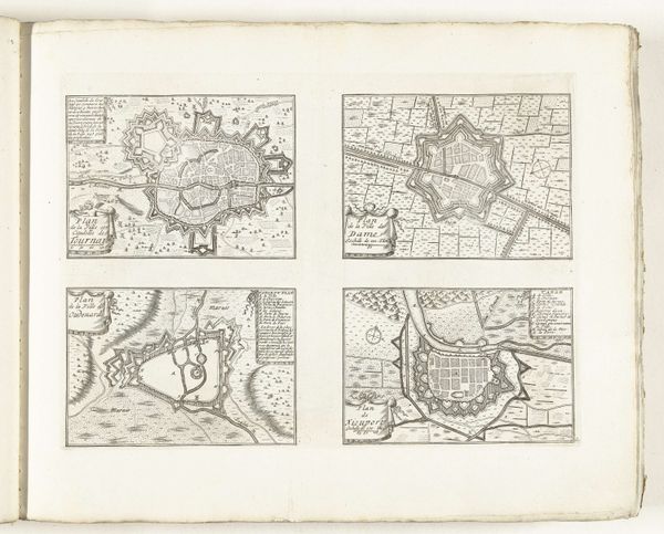
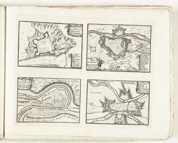
Laurens Scherm made these maps of Luxemburg, Thionville, Montmédy and Damvillers around 1702. Note the star-shaped fortifications, each point designed to offer maximum defensive fire, a symbol of power and control. This star motif isn't new; we see it echoing through history, from ancient city plans to Renaissance fortresses. Consider, for instance, the ideal city layouts proposed by Renaissance architects, where the star symbolized both divine order and military strength. This concept evolved from earlier fortifications, yet the symbolic intent – protection, dominance – remains strikingly consistent. These shapes elicit a visceral response, rooted in a collective memory of sieges and battles. The walls evoke a sense of security, yet their very structure speaks of conflict and potential violence. Observe how such designs have resurfaced, adapted, and reinterpreted across centuries.
Comments
No comments
Be the first to comment and join the conversation on the ultimate creative platform.
More like this