About this artwork
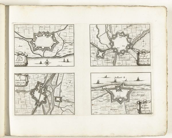
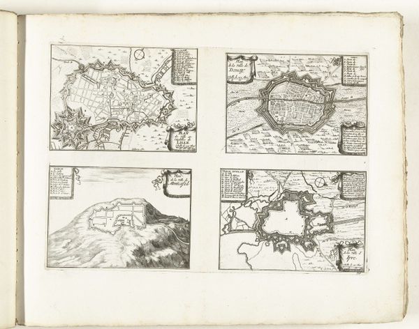
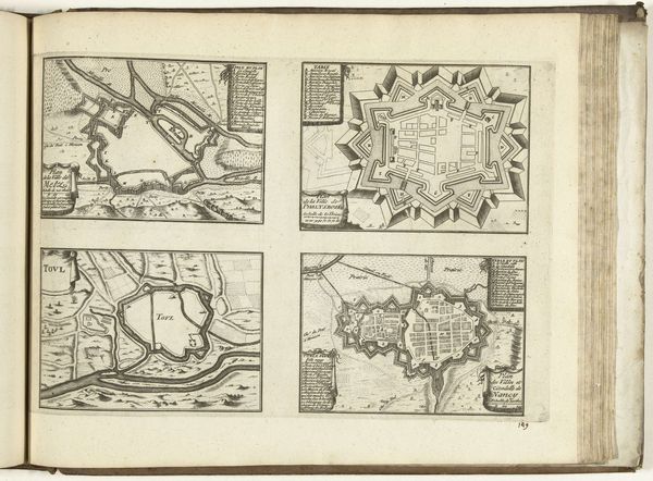
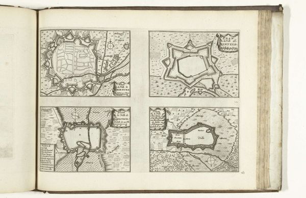
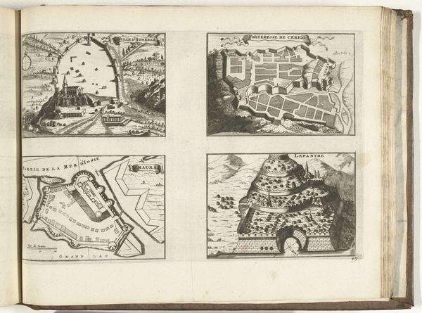
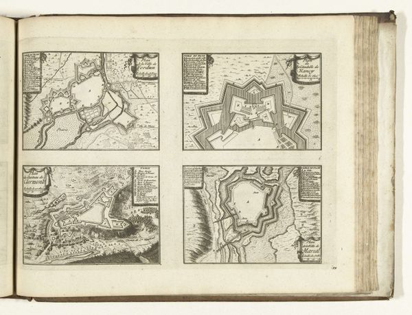
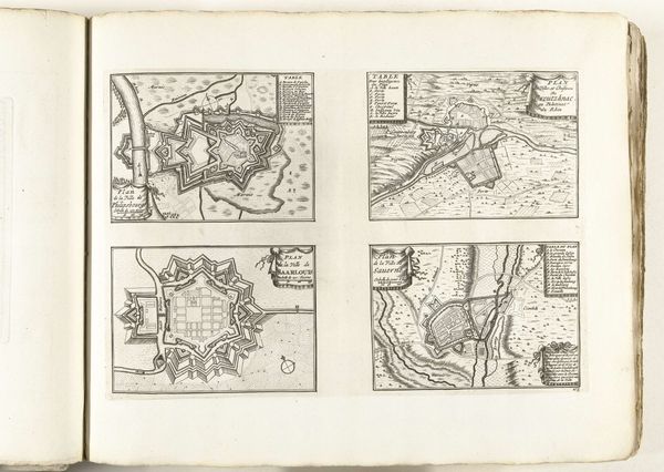
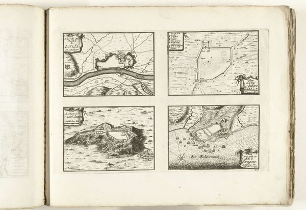
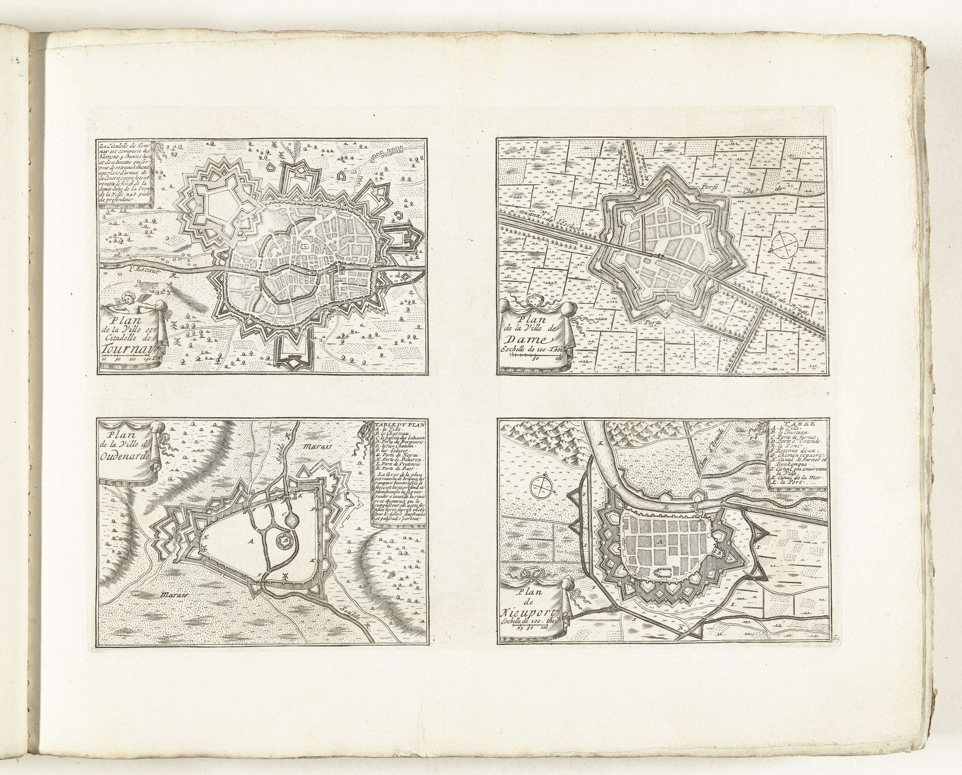
This undated print from around 1702 shows plans of Tournai, Damme, Oudenaarde, and Nieuwpoort, four cities within the Spanish Netherlands, all rendered in ink on paper by an anonymous artist. Look closely and you will see that each city plan is displayed in a bird's eye view, emphasizing fortifications and layouts. The Spanish Netherlands, now modern-day Belgium, was the scene of intense geopolitical conflict, so military engineering became a very important function in society. The star-shaped fortifications you see here reflect the influence of early modern military theory, designed to defend against siege warfare. These maps weren't just representations, they were tools of power, and the institutions that commissioned them had a vested interest in maintaining control. Understanding the social and institutional context of this print requires us to ask: who needed these maps, and why? A historian might look at military archives, engineering treatises, and political correspondence to understand its true purpose. Art like this helps us see the relationship between culture, power, and knowledge in early modern Europe.
Plattegronden van Tournai, Damme, Oudenaarde en Nieuwpoort, ca. 1702 1702 - 1703
Anonymous
@anonymousLocation
RijksmuseumArtwork details
- Medium
- drawing, print, ink, engraving
- Dimensions
- height 247 mm, width 341 mm
- Location
- Rijksmuseum
- Copyright
- Rijks Museum: Open Domain
Tags
drawing
baroque
old engraving style
ink
geometric
cityscape
engraving
Comments
No comments
About this artwork
This undated print from around 1702 shows plans of Tournai, Damme, Oudenaarde, and Nieuwpoort, four cities within the Spanish Netherlands, all rendered in ink on paper by an anonymous artist. Look closely and you will see that each city plan is displayed in a bird's eye view, emphasizing fortifications and layouts. The Spanish Netherlands, now modern-day Belgium, was the scene of intense geopolitical conflict, so military engineering became a very important function in society. The star-shaped fortifications you see here reflect the influence of early modern military theory, designed to defend against siege warfare. These maps weren't just representations, they were tools of power, and the institutions that commissioned them had a vested interest in maintaining control. Understanding the social and institutional context of this print requires us to ask: who needed these maps, and why? A historian might look at military archives, engineering treatises, and political correspondence to understand its true purpose. Art like this helps us see the relationship between culture, power, and knowledge in early modern Europe.
Comments
No comments