print, engraving
# print
#
old engraving style
#
geometric
#
cityscape
#
history-painting
#
engraving
Dimensions: height 297 mm, width 428 mm
Copyright: Rijks Museum: Open Domain
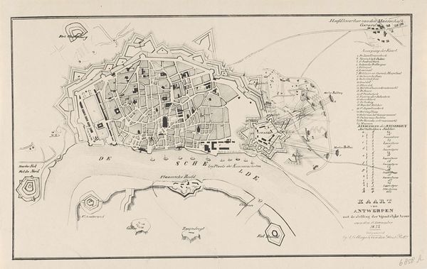
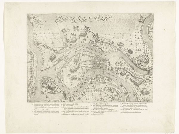
This is an anonymous map print of Antwerp and its Citadel, made in 1832. The composition is dominated by a monochromatic palette of grey ink on a pale background, lending it a stark, almost clinical feel. The rigid lines and geometric shapes used to represent the city's layout and fortifications evoke a sense of order, but also confinement. The city is meticulously mapped out, yet the style also reveals the values and assumptions that shape our understanding of urban spaces. The Citadel, with its star-shaped design, symbolizes power and control. The river Scheldt cuts through the composition, providing a natural boundary and element of movement. The map functions as a tool for understanding space and power, while the rigid lines and monochromatic palette remind us of the constraints and structures that define urban life. Its enduring value lies in its ability to provoke ongoing dialogues.
Comments
No comments
Be the first to comment and join the conversation on the ultimate creative platform.
More like this