drawing, print, paper, watercolor
#
drawing
# print
#
landscape
#
paper
#
watercolor
#
coloured pencil
#
cityscape
Dimensions: height 147 mm, width 123 mm
Copyright: Rijks Museum: Open Domain
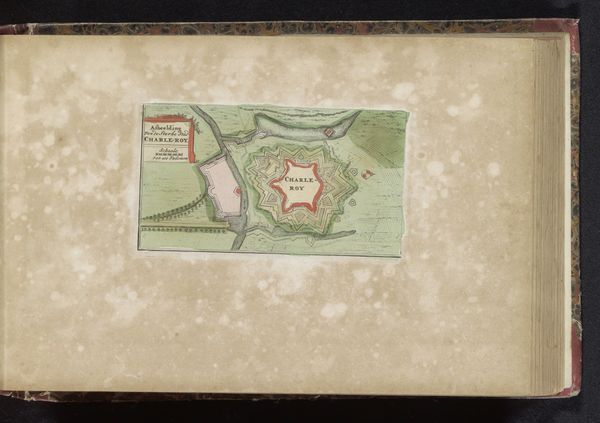
This is an anonymous plattegrond, or map, of Wismar, created without a known date, rendered with ink and color wash. Wismar, a port city on Germany’s Baltic coast, experienced waves of shifting political control, reflecting the broader dynamics of power and identity in early modern Europe. What strikes me is how this map does more than simply chart geographical space; it encapsulates ideas of geopolitical strategy, especially considering Wismar's history as a sought-after territory. The star-shaped fortifications are not merely defensive structures; they are assertions of dominance and control over movement and access. Consider, too, what it might have meant to the inhabitants of Wismar to see their home depicted in this manner. How did the act of mapping influence their understanding of their place in the world? This plattegrond of Wismar then, is less a neutral depiction and more a layered statement about power, place, and identity.
Comments
No comments
Be the first to comment and join the conversation on the ultimate creative platform.
More like this