drawing, painting, paper, watercolor
#
drawing
#
painting
#
landscape
#
paper
#
watercolor
#
coloured pencil
#
cityscape
#
watercolor
Dimensions: height 165 mm, width 270 mm
Copyright: Rijks Museum: Open Domain
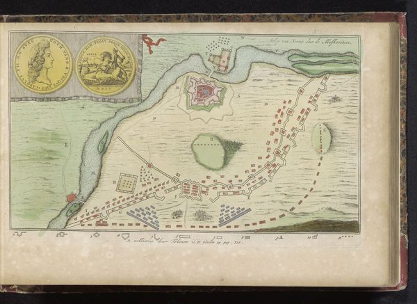
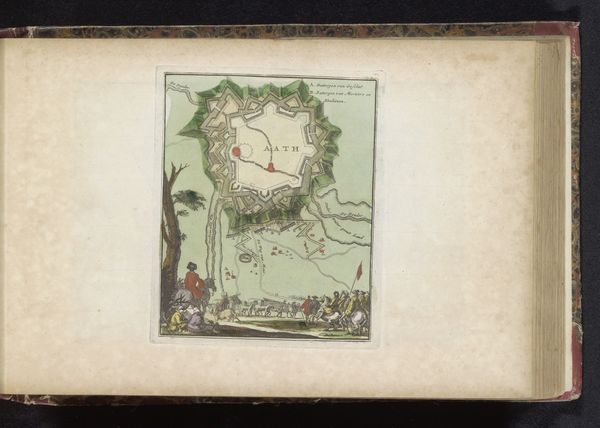
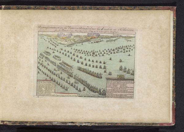
This map, made in 1702 by an anonymous artist, depicts the siege of Kaiserswerth with a striking combination of precision and artistry. The formal structure is immediately apparent: a careful arrangement of land, water, and fortifications, rendered in delicate lines and muted colors. The composition is divided into distinct zones, each conveying specific information about the landscape and the siege. The use of color is particularly noteworthy. Pale greens and yellows define the fields and open spaces, contrasting with the steely blues of the Rhine. Red dots trace the line of the besieging forces, creating a visual boundary that encloses the town. This semiotic system of color-coding allows the viewer to quickly grasp the dynamics of the siege. The map's formal qualities are not merely aesthetic. The very act of mapping is an assertion of control and understanding. It reduces a complex, chaotic event to a set of manageable signs, transforming warfare into a legible landscape. This interplay between form and meaning invites us to consider how maps themselves shape our perception of space and power.
Comments
No comments
Be the first to comment and join the conversation on the ultimate creative platform.
More like this