About this artwork
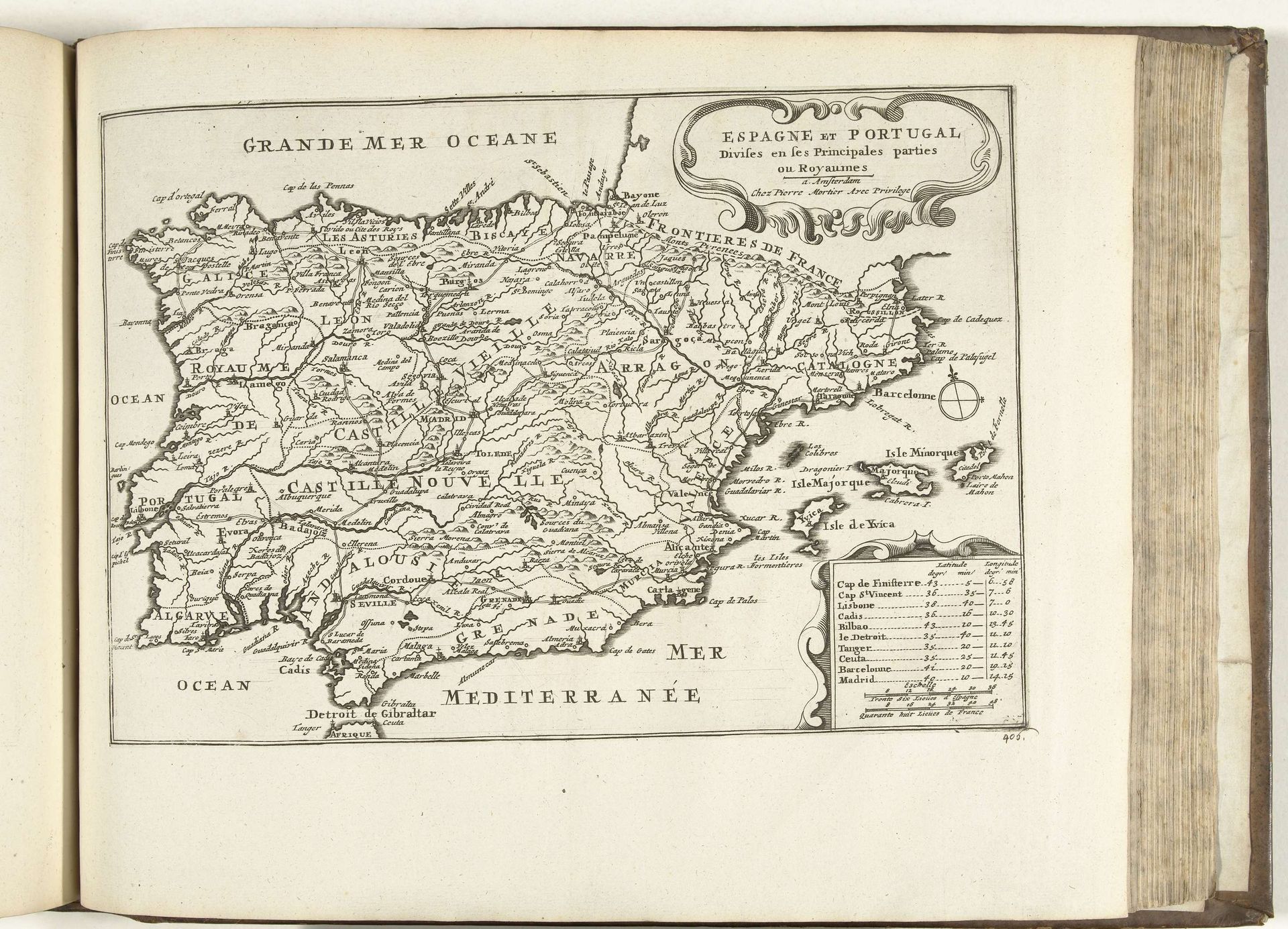
This map of Spain and Portugal was anonymously made in 1726 using printmaking techniques. Look closely, and you can see the distinct lines created by an engraver’s tool. This wasn’t just about information; it was about skillful execution. The material here – paper and ink – might seem humble. But consider the labor involved. From papermaking, to engraving the metal plate, to the printing process itself. Each stage required skilled artisans. The crisp lines, the precise lettering – these speak to a culture of craft and precision. Maps like this weren’t just functional. They were tools of power. They guided trade routes and military campaigns, projecting control over vast territories. This map embodies both artistry and geopolitical ambition. It challenges us to see beyond the image and consider the hands and historical forces that brought it into being.
Artwork details
- Medium
- print, engraving
- Dimensions
- height 219 mm, width 314 mm
- Location
- Rijksmuseum
- Copyright
- Rijks Museum: Open Domain
Tags
Comments
Share your thoughts
About this artwork
This map of Spain and Portugal was anonymously made in 1726 using printmaking techniques. Look closely, and you can see the distinct lines created by an engraver’s tool. This wasn’t just about information; it was about skillful execution. The material here – paper and ink – might seem humble. But consider the labor involved. From papermaking, to engraving the metal plate, to the printing process itself. Each stage required skilled artisans. The crisp lines, the precise lettering – these speak to a culture of craft and precision. Maps like this weren’t just functional. They were tools of power. They guided trade routes and military campaigns, projecting control over vast territories. This map embodies both artistry and geopolitical ambition. It challenges us to see beyond the image and consider the hands and historical forces that brought it into being.
Comments
Share your thoughts