graphic-art, print, etching, intaglio, ink, engraving
graphic-art
baroque
dutch-golden-age
pen illustration
etching
intaglio
landscape
ink
geometric
line
cityscape
engraving
Dimensions: height 271 mm, width 427 mm
Copyright: Rijks Museum: Open Domain
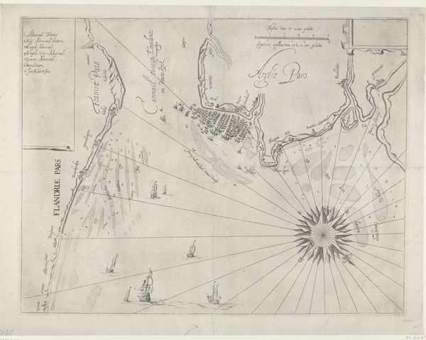
This is an anonymous map of the area around Venice, made around 1702. The map offers insight into the political, economic and military concerns of the time. Produced in Amsterdam, it reflects the Dutch Republic’s interest in Venetian territories and trade routes. Note the presence of sailing ships: these vessels evoke maritime power, commerce, and potential conflict in the Adriatic Sea. The detailed rendering of the lagoon and surrounding areas would have served practical purposes for navigation and defense. Venice, by this time, was no longer the major naval power it once was, but it still held considerable symbolic and strategic importance. As historians, we would examine this map in the context of early modern European geopolitics, Dutch cartography, and Venetian history. Comparing it with other maps, documents, and accounts from the period can reveal its intended audience, its accuracy, and its place within broader cultural and institutional narratives.
Comments
No comments
Be the first to comment and join the conversation on the ultimate creative platform.