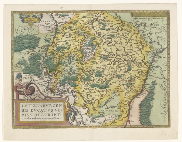
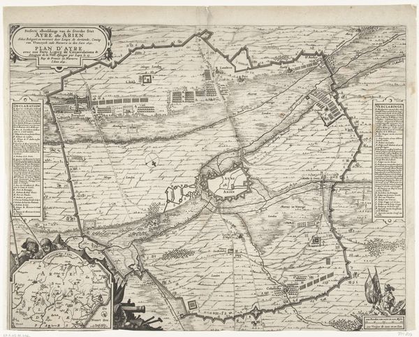
print, engraving
baroque
asian-art
landscape
engraving
Dimensions: height 504 mm, width 600 mm
Copyright: Rijks Museum: Open Domain
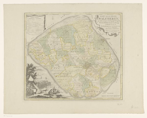
Editor: So, here we have Gerard van Keulen’s "Kaart van Zuid-India," dating back to about 1720. It's a printed map—an engraving, to be exact—from the Rijksmuseum's collection. What strikes me is the way it blends scientific precision with such a decorative, almost romantic style. How would you interpret this work? Curator: Ah, maps! Aren't they glorious little poems of ambition and perspective? This one is fascinating because it’s not just about charting a territory, it's about claiming it, or at least understanding it, from a very specific European viewpoint. Van Keulen presents not only geographic details, but cultural narratives embedded in those lovely Baroque flourishes. The details—like ships at sea, compass roses—become little players in a grander theater of trade and influence. What sort of story do those flourishes suggest to you? Editor: Well, to me, it suggests a real sense of... control. A desire to impose order on a place that, at the time, must have seemed incredibly foreign and complex. The way the land is neatly divided into these coloured sections, it almost feels like possession. Curator: Precisely! It's cartography as a form of colonization, a way of visually mapping power. Look how place names are rendered; priorities are assigned! Even the very act of translation is a sort of... artistic license. This map then, becomes a beautiful, unsettling relic of a bygone era. Does it shift your perspective to think of this document as propaganda? Editor: Definitely. It’s easy to get lost in the details and forget the bigger picture—that this wasn't just about geography, it was about geopolitics. Thanks, I’ll keep that in mind moving forward! Curator: Glad to have guided the way, just a bit, with my artistic map.
Comments
No comments
Be the first to comment and join the conversation on the ultimate creative platform.