drawing, print, etching, ink, architecture
#
drawing
#
medieval
#
dutch-golden-age
# print
#
etching
#
landscape
#
etching
#
ink
#
geometric
#
cityscape
#
architecture
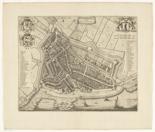
Dimensions: height 398 mm, width 502 mm
Copyright: Rijks Museum: Open Domain
This is an undated, anonymous map of Vollenhove, rendered in ink on paper. Its presence in the Rijksmuseum speaks to the institutional importance of cartography in Dutch history. The map's visual codes offer a glimpse into the cultural values of the time. The neat, orderly arrangement of buildings and gardens suggests a society that prized structure and control. The inclusion of heraldic symbols reflects the importance of family and social status. Vollenhove's position on the Zuider Zee was economically strategic, providing access to trade routes. The map might have been commissioned by the local government, as a tool for planning and governance. As a historical document, this map offers insights into the social, economic, and political structures of its time. By researching local archives, tax records, and other historical sources, we can gain a deeper understanding of the society that produced it and the meanings it held for its original audience.
Comments
No comments
Be the first to comment and join the conversation on the ultimate creative platform.
More like this