print, engraving
#
dutch-golden-age
# print
#
geometric
#
line
#
cityscape
#
engraving
Dimensions: height 252 mm, width 322 mm
Copyright: Rijks Museum: Open Domain
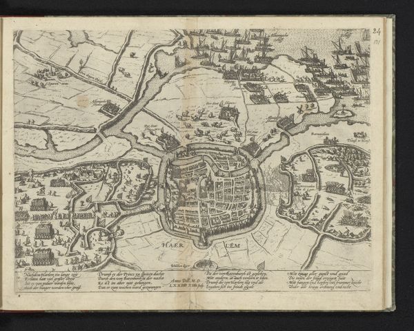
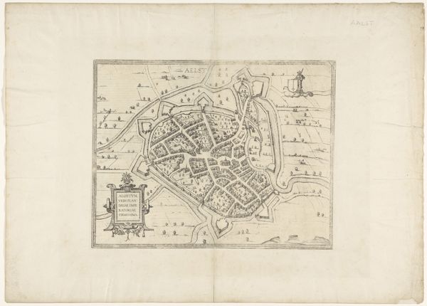
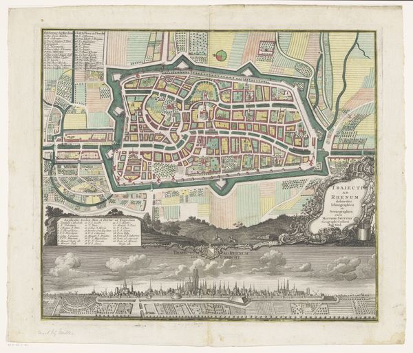
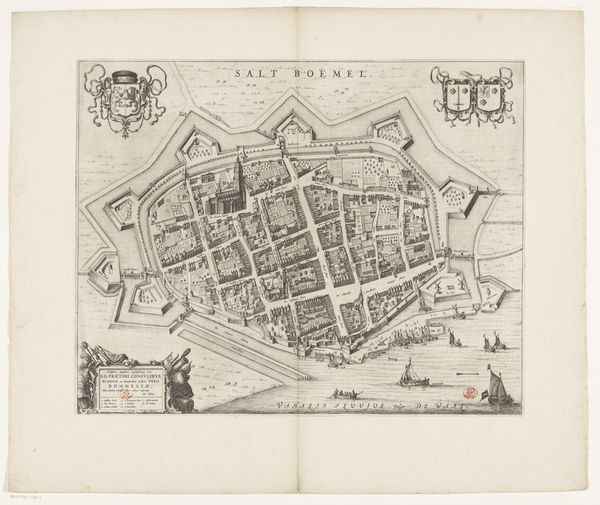
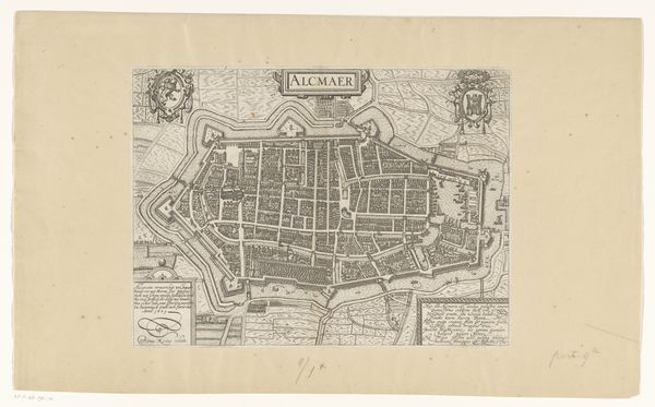
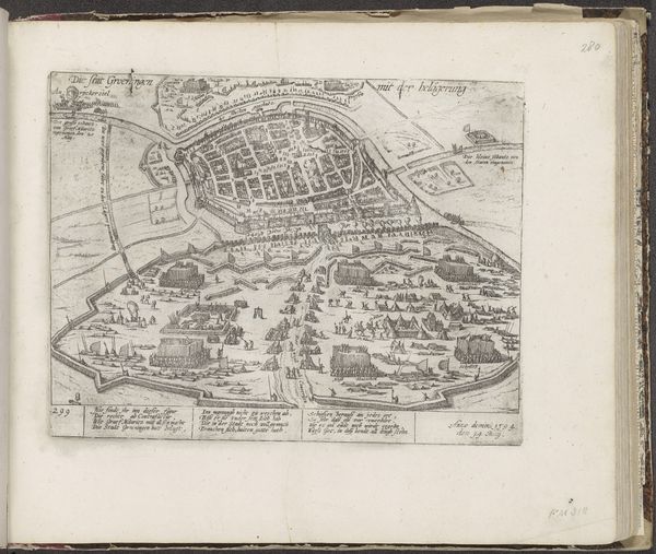
Curator: This delicate engraving presents a bird's-eye view of Den Haag. Although dated 1730, it is a copy of a city plan made around 1560, rendered by an anonymous artist and housed here at the Rijksmuseum. The fine lines describe streets, buildings, and even suggest the textures of cultivated lands outside the city walls. Editor: My immediate impression is how precise and almost obsessive the rendering is. Every street, every little tree, seems painstakingly recorded. It’s captivating, yet it also feels very controlled, almost…bureaucratic. Curator: I see that, and it connects to how city planning evolved. Early modern cartography wasn't just about wayfinding. Maps became instruments of power, tools for governance and control, reflecting urban growth and societal shifts. What materials are used in its creation also plays a major role as print became increasingly normalized at the time. Editor: Absolutely, because while looking at those crisp lines, one thinks about the societal context that framed such detailed work. Consider the socio-political landscape of the Dutch Republic, its merchant class, its budding empire. These prints circulated among people, defining Den Haag. It’s not a simple “here is how you find your way.” Curator: Precisely! These were consumed and shaped understanding of the territory and even instilled civic pride. It makes me curious who this Anonymous was and to what audience it was catered for, given its fine detailing of city landscapes. Editor: Good questions to keep in mind. As a viewer, tracing the street designs makes you ponder about city expansion, about trade routes, social districts; I get an insight on city growth that goes way beyond aesthetic pleasure. Curator: And think about the act of printing itself, how knowledge and vision get disseminated so broadly! Editor: Exactly! Examining "Plattegrond van Den Haag, 1560" through history transforms a simple map into a multi-layered artifact filled with tales on process and perception. Curator: Indeed, it seems from every corner and line in the engraving emerges so many avenues for analysis! I hope it’s just as inspiring for those visiting it here at the Rijksmuseum!
Comments
No comments
Be the first to comment and join the conversation on the ultimate creative platform.
More like this