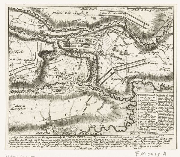
print, etching
#
baroque
# print
#
etching
#
landscape
#
etching
#
personal sketchbook
#
cityscape
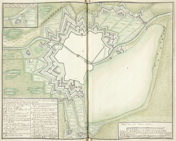
Dimensions: height 518 mm, width 1360 mm
Copyright: Rijks Museum: Open Domain
Editor: Here we have a fascinating etching titled "Kaart van Mons en Saint-Ghislain en omgeving", created around 1709 by Samuel Du Ry de Champdoré. It depicts a map of the cities Mons and Saint-Ghislain and their surroundings. The level of detail is incredible. What immediately strikes me is how the natural landscape seems to embrace and even dictate the layout of the urban spaces. How do you interpret this work? Curator: That's a keen observation. This map isn't simply a factual record; it's deeply embedded in the political and military landscape of the early 18th century. The detailed fortifications signal a society constantly preparing for war, a visual manifestation of power. The Baroque era highly valued order, control, and imposing grandeur, traits seen throughout the urban planning, yet equally there’s an undeniable focus on the rendering of the landscape and geography, something which must be related to military and political control of these spaces. Does this emphasis on defence and order resonate with your understanding of Baroque art in other forms? Editor: Absolutely. Think of Versailles; everything about it screams power and control! So, the artistry in this map isn't just about cartography; it’s propaganda. Curator: Precisely. Maps were tools of power, influencing not only military strategy but also shaping public perception. The placement of Mons and Saint-Ghislain, their strategic importance visually highlighted, reflects the institutional authority that commissioned this piece. It wasn’t just about showing where things *are*, but about asserting *why* they matter. Editor: That’s so insightful. I hadn't considered the persuasive role of maps beyond their navigational function. Curator: Think about how maps still function today, influencing our understanding of geopolitical relations and resource allocation. Art like this reminds us that even seemingly objective representations are inherently shaped by socio-political forces. Editor: It really gives me a new appreciation for how much context can influence a work's meaning. Thank you.
Comments
No comments
Be the first to comment and join the conversation on the ultimate creative platform.
More like this